Rapid Coastal Zone Assessment Surveys (RCZAS) aim to determine the nature and extent of archaeological remains within the coastal landscape. The RCZAS programme is particularly important when the effects of coastal erosion and the impact of development, which are causing irreparable damage to the coastal heritage, are considered. This highlights the importance of thoroughly recording each monument or feature and undertaking the associated research prior to this landscape alteration. Furthermore, the assessments aim to serve as a basis for understanding landscape change and development, and contribute towards improved management of the coastal historic environment in the future.
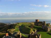 The study area that Wessex Archaeology will investigate is located in the south-east of England, and is one of the last Rapid Coastal Zone Assessment Surveys (RCZAS) to be initiated. Along with the other RCZAS completed for other areas of the UK coast, this project has been commissioned by English Heritage, who intend to complete a full archaeological survey of the entire English coast by 2013. The area that we will investigate covers a distance of over 200 miles of coastline from Redbridge at Totton in Hampshire in the west to White Ness, Kingsgate in Kent in the east. It extends seaward to six nautical miles and inland to either one kilometre or to the five metre contour line (dependent on which has the furthest distance from the coastline). The project is split into two separate phases. Phase 1 encompasses the desk-based assessment of the area, which includes not only the compilation and analysis of known archaeological sites in the area, but also the analysis of relevant aerial photographs held in the English Heritage archives at the National Monuments Records. The scanning of these photographs and digitising of apparent archaeological features will feed into the National Mapping Programme, providing an extensive amalgamation of the UK’s archaeological/military remains that are visible from the air. Phase 2 consists of the field assessment and aims to ground truth and supplement the results from the initial phase. This phase will also conclude with the compilation of the final report. Using aerial photographs, historic maps and charts, existing archaeological and historical records, analysis of some ground elevation data called LiDAR, together with a walkover survey of the area, we hope to build up a comprehensive catalogue of the types and extents of archaeological remains that exist along this extremely diverse and culturally interesting coastline.
 Several external sources will provide us with existing archaeological, historical, and military information already known to lie within our study area, including the National Monuments Record (and the National Mapping Programme), local Historic Environment Records and Sites and Monuments Records, and the United Kingdom Hydrographic Office. And in turn, the results that we will generate from the project will be given back to these sources to supplement and enhance their records. This is an excellent means of gathering and sharing locally, nationally and potentially internationally important data that can be accessed by all. From the 500,000 year old human remains at Boxgrove to the intense military activity in and over the Straits of Dover during World War II, it is likely that all archaeological and historical periods will be represented on the South East coast by a huge variety of archaeological features. We will be regularly updating Splash with news on the project’s progress, so be sure to watch this space!