"The real voyage of discovery consists not in seeking new landscapes but in having new eyes" - Marcel Proust
England’s Historic Seascapes is a pilot historic landscape characterisation (HLC) project commissioned by English Heritage. The project will develop a methodology for extending existing HLCs into the inter-tidal and marine zone focussing initially on a study area in Liverpool Bay.
What is Historic Landscape Characterisation?
Historic landscape characterisation is a way of describing and displaying the physical, environmental and human-made changes and components that have made the landscape appear as it does today. It can be used as a heritage management tool, ensuring any changes or impacts on the landscape are appropriate to its historic character. It provides a broader understanding of the heritage of an area by including every part of the landscape by providing the context to individual sites and monuments.
Developing England’s Historic Seascapes
England’s Historic Seascapes Project has progressed through a series of phases:
Phase 1: Familiarisation, Data Sourcing and Draft Methodology
To begin with the project team undertook a review of terrestrial HLC projects to identify aspects of good practice. They also undertook interviews with potential end users to explore their aspirations for the Seascapes. Contact was made with holders of potential useful marine data to request access. Three conceptual models for characterisation were also produced for discussion.
Phase 2: Characterisation
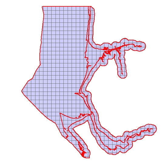
Three different methods for dividing the study area were explored. The method finally taken forward for development included the creation of themed mapping collating information by period and by themes often featured in Regional Research Frameworks, such as military and industry. The mapping was grouped under broad headings reflecting modern use of the sea and coast, past use of the sea and coast, and environmental characteristics such as natural habitats and palaeoenvironmental contexts. A model of coastal change was also compiled to help assess the potential for submerged landscapes. Features from the various themed maps were then combined into a single layer of polygons.
Phase 3: Analysis and Interpretation
The patterns of human activity revealed by the characterisation process were analysised to find areas where polygons of similar characteristics were found in close proximity. These areas were then defined as ‘Character Areas’ and text generated summarising Present Day Form, Present Sea Use, Past Sea Use, Archaeological Potential, Perception and Sensitivity to Development. Each text was accompanied by a listing of bibliographic references. These text were converted into html pages which can be accessed via the GIS or as a standalone WWW application.
A variety of multi-media including historic images, digital stills and panoramas, and video footage has also been linked to the character areas via the html pages.
Phase 4: Review
The review of Seascapes characterisation included developing management case studies and assessing the ways in which Seascapes might be useful. The case studies included Rapid Coastal Zone Assessment Surveys, the revision of Shoreline Management Plans, development proposals for an offshore windfarm and marine aggregates extraction area.
Phase 5: Dissemination
England’s Historic Seascapes project team have undertaken a variety talks including presentation of the results at the IFA’s Annual Conference in Edinburgh, April 2006. The project will also be appearing in short features in forthcoming journals.

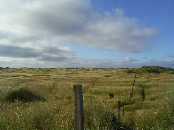
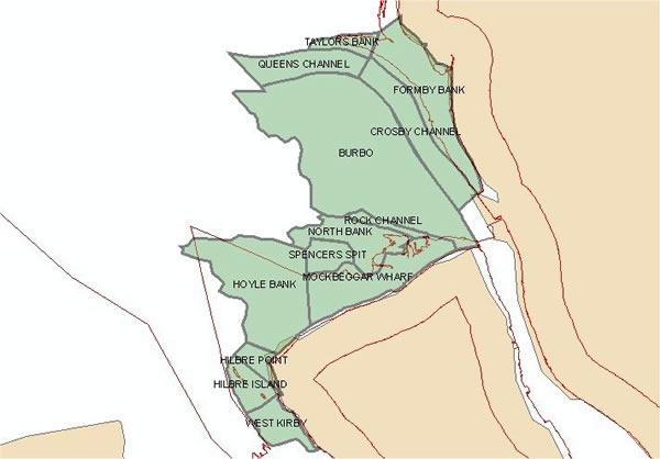
The first pilot area for England’s Historic Seascapes extends from the Dee Estuary in the south to Rossall Point in the north, and incorporates Liverpool Bay as far offshore as the 12 nautical mile limit of territorial waters.
The coastlines of both Lancashire and Cheshire contain areas of submerged forest. Human and animal footprints from the Neolithic or early Bronze Age survive in the intertidal zones in Merseyside. In the intertidal area of the Wirral large numbers of Roman and Medieval finds are known. Such discoveries show a clear potential for the human occupation of landscapes that are now inundated.
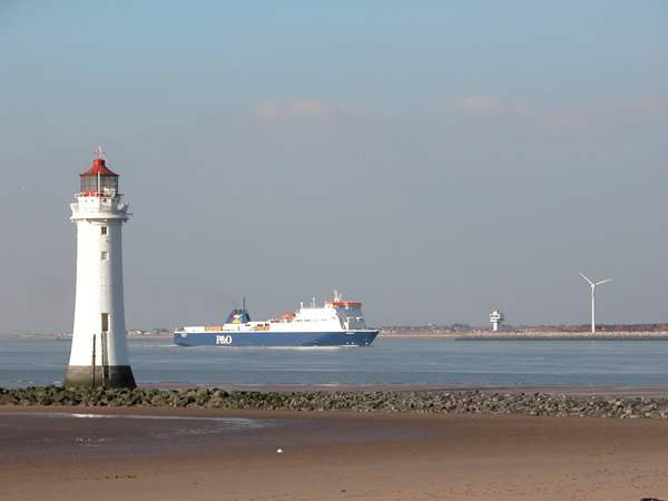
Liverpool Bay has seen maritime activity from at least the Roman period. Sea going vessels would have navigated the Dee and Irish Sea to and from the Roman town of Deva - now modern Chester. Placenames such as Formby and Flyde show Viking activity in the region and in Medieval times Chester and Liverpool were used as maritime bases for military campaigns in Wales and Ireland.
In the Medieval and Post-Medieval periods, Liverpool grew as a port to become a centre for trade with the New World colonies, including the trade in slaves. After the abolition of slavery, Liverpool remained a busy port exporting coal, salt and textiles. In the eighteenth century, an extensive new dock system was built to facilitate further expansion in trade, and by 1851 Liverpool was exporting more goods than London.
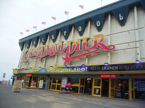
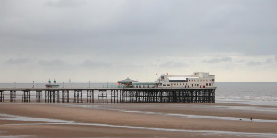
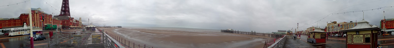
Other ports in the pilot area, such as Southport and Fleetwood, though never challenging Liverpool in export and import, remained active in coastal trade and fishing. Other towns on the coast like Blackpool grew greatly due to the growth of tourism in the nineteenth century bringing further prosperity to the region.
Offshore, the pilot area contains valuable resources such as the Douglas and Hamilton gas fields which are extensively exploited. Growing modern interest in renewable energy sources has led to parts of the pilot area being selected for the construction of offshore windfarms.
As can be seen, not only has Liverpool Bay a rich and varied maritime history, but it has wide range of development pressures and management issues which maritime historic landscape characterisation will help to address.