At the end of 2015, Wessex Archaeology decided to upgrade their geophysics capabilities by acquiring some really interesting new devices.
The initial push to get this new equipment came from the need to solve a series of issues that the Geophysics team have to face in the field every day, it also needed to be something that would improve productivity and the quality of data collected, while overcoming some of the problems encountered on site such as harsh weather conditions, complex land features and GPS signal failures, all of which can very often influence the successful conclusion of a project.
Paul Baggaley, Head of the Geo-Services Department at Wessex Archaeology, paid a visit to Bartington Instruments upon which decided to purchase their new Non-Magnetic Geophysics Cart.
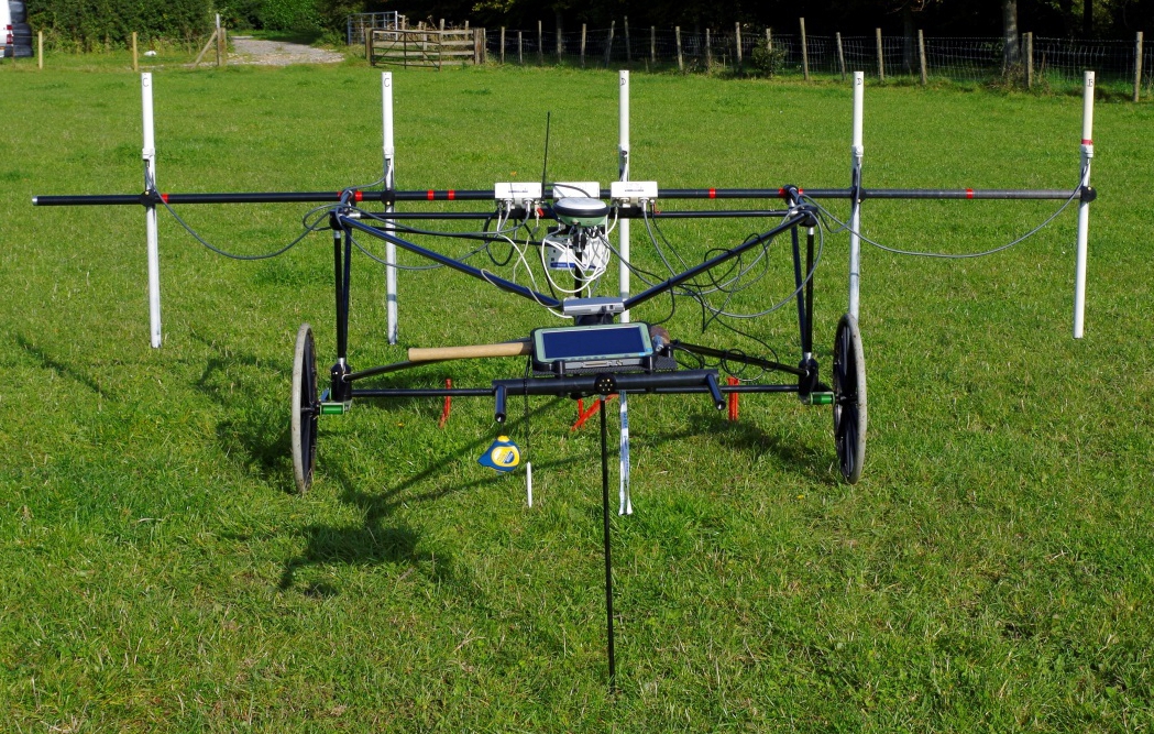
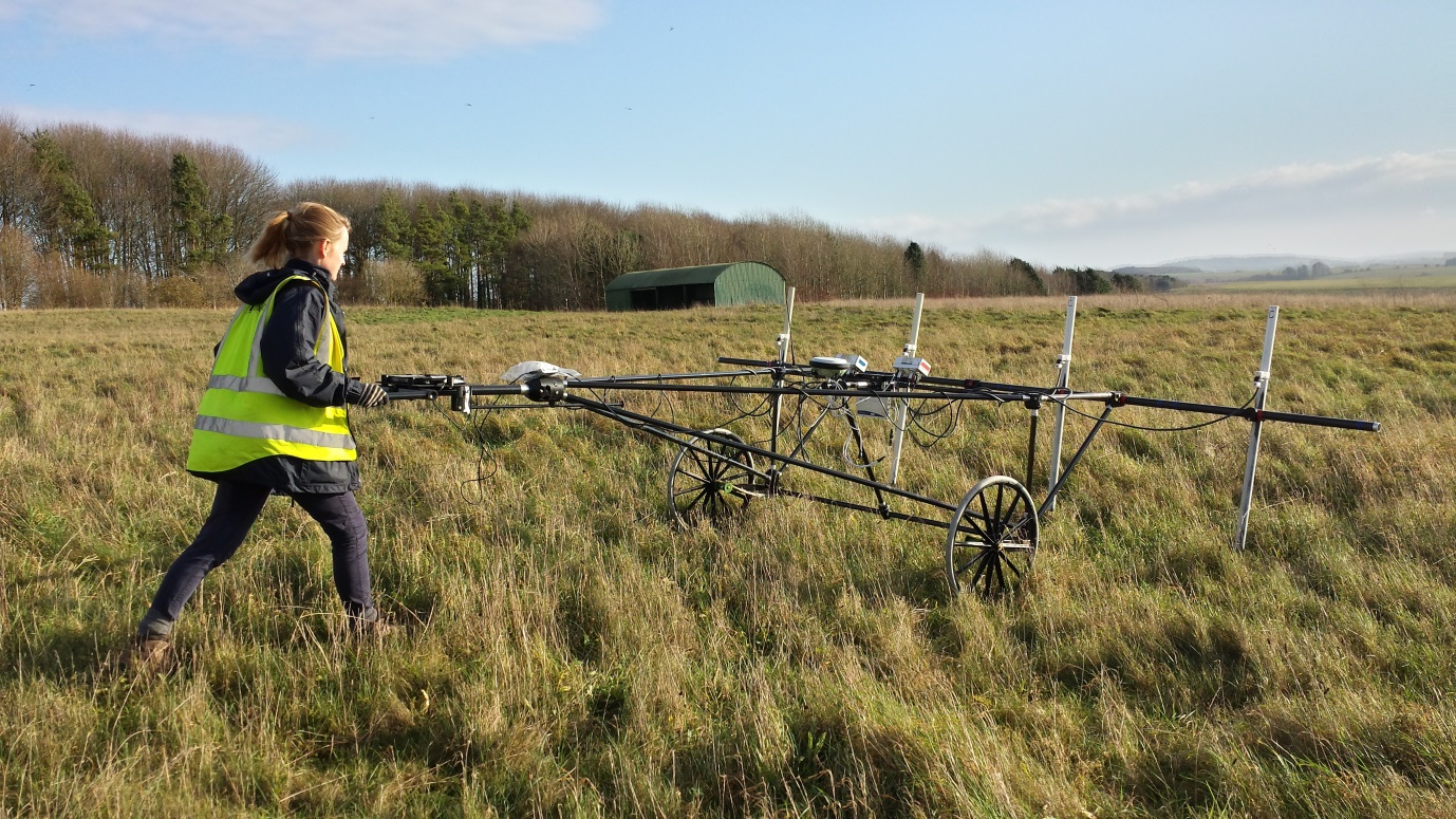
The carbon fibre cart is designed to host up to 12 Grad-13 or Grad 01 Gradiometers together with their data loggers. This particular cart is 3 metres long, only weighs 20 kg and can be pushed by one-person or alternatively towed by a small vehicle. The cart can be easily transported in the back of a small van and it is really light to push and can mount up to 12 sensors which considerably improves the number of sensors that can be operated by one person. (Normal gradiometer surveys are done with two sensors mounted on a bar and operated by one person at a time).
The cart works in conjunction with a GPS and a laptop and is designed to have a constant stream of GPS data so that all the data coming from the gradiometers is spatially referenced; the laptop is used to gather data from the different sensors.
The GPS antenna is placed in the middle where there is space allocated and the laptop is located in the front near the operator. However, there are a few flaws in this system. Firstly, the cart needs a constant stream of positioning data from a GPS, but the system can experience several data dropouts and signal failures during the day which does not provide the constant data flow required. Another issue is the presence of the laptop to collect the data coming from the sensors; this idea seemed a bit impractical even with a fully rugged device. It became clear that the cart needed a different data logging and positioning system.
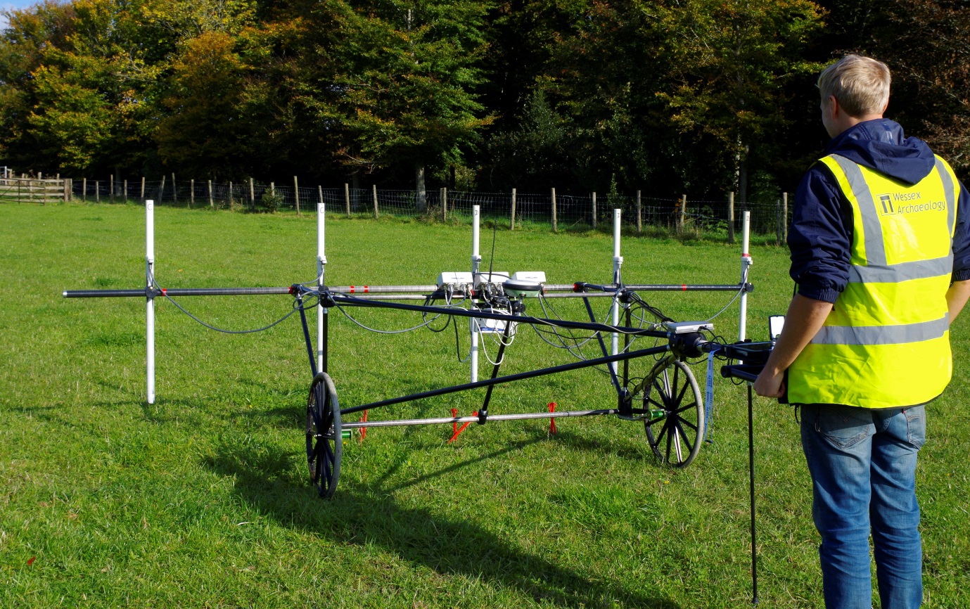
During consultations between Damien Campbell-Bell, Geomatics Officer at Wessex Archaeology, and Doug Murphy Account Manager and GPS specialist at Opti-cal Survey Equipment, they came up with an idea. Doug suggested trying the GS14 RTK Base and Rover Kits with GS08+ NetRovers and the CS35 Panasonic Field Controller from Leica Geosystems.
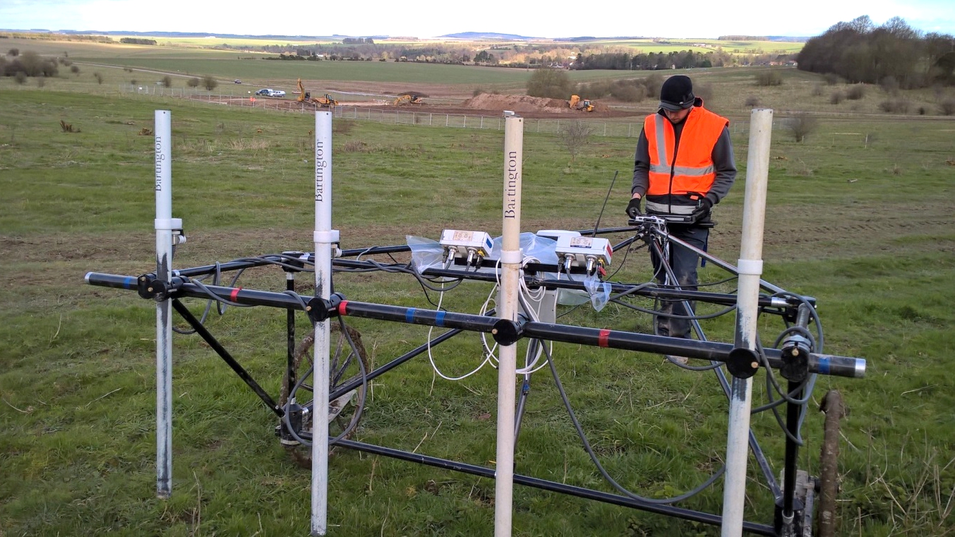
The CS35 Tablet Controller has been specifically modified by Panasonic to work with Leica equipment and features the new Leica Captivate software. The controller can receive data from both the Rover and the Sensors, and can be mounted in front of the cart and is easily controllable by the technician operating the cart. The Rover Antenna is mounted in the middle behind and close to the Sensors, which records the position of the gradiometer data as it is being collected and sends signals to the base, which would be set up in a static position in the field.
This system overcomes the usual GPS signal failures as the Rover sends the positions to the base via a radio signal while the base, set-up on a known point, calculates the positions of the Rover according to its own or it can also be connected to an RTK Network to establish the coordinates of its own location at the beginning of the survey.
This way a constant flow of satellite data is not required but the positions are given continuously to the cart via the Rover. Opti-cal arranged some trials on the field with Wessex Archaeology’s geophysicists to test the system together and immediately it become clear that the solution was spot on! The team realised that the set-up was quick and easy, taking only 30 minutes.
So far, the Bartington Geophysics Cart coupled with the Leica Base and Rover as well as the CS35 Panasonic Tablet Controller has been able to achieve the completion of geophysicical surveys very quickly, as it takes less time on large areas for the possibility of hosting a bigger number of sensors.
The presence of the Leica Base and Rover has solved the usual problem of signal dropouts when using GPS, making the system more stable and reliable during surveys.
The choice of the CS35 Panasonic Tablet Controller from Leica Geosystems over a rugged laptop has been a way better solution, the Tablet Controller can operate under harsh weather conditions and is more manageable than a laptop; also the system once put together looks very neat as the quantity of flying cables is diminished.
Moreover, something that was not considered initially is that rather than downloading the data from the laptop and the GPS separately, now the data can be downloaded all together from the Tablet Controller (geophysics and geospatial data from the Base and Rover), cutting down the number of operations required for processing.
On the Tablet, the Leica Captivate software used for topographical surveys can be turned off and the user can access a desktop featured Tablet which works just like a normal Tablet so the data can also be sent via email etc. In addition, wherever the ground conditions are really complex, the Cart can now perform topographical and geophysicical surveys at the same time also improving the grade of detail and quality of data collected.
The integration of the Bartington Cart and Leica Base and Rover provided by Opti-cal has proven to be a success in combining different products on the market to develop an efficient geophysics and survey system which answers the needs of the Geophysics team, raises the productivity and overcomes the daily difficulties encountered in the field every day.