27.741175502151, 37.509615789168
Project summary
- Client: The Royal Commission for AlUla (RCU)
- Colleagues: Heritage Conservation Consulting (HCC)
- Location: Tabuk County, Saudi Arabia
- Project duration: October 2023 – April 2025
- Sector: Heritage Conservation
Services provided
- Archaeological Recording
- Historic Building Recording
- 3D laser scanning
- Photogrammetry
Key facts
- The site has been recorded as a stop on the Syrian Hajj route since 1215
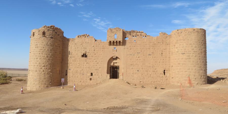
- Al-Muazzam Fort was originally constructed in 1622. It underwent further phases of construction in 18th, 19th and early 20th century.
- The fort is a component of two elements of the Saudi UNESCO World Heritage Tentative List: the Syrian Hajj Road and the Hejaz Railway. The lists represent sites that have an outstanding universal value and are under discussion for formal recognition as World Heritage Sites.
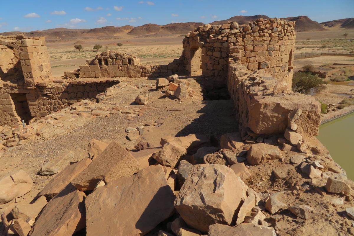
Above: looking out from the remains of the parapet, the water collection pool is visible to the right
Background
In October 2023, staff from Wessex Archaeology travelled to the Kingdom of Saudi Arabia to support The Royal Commission for AlUla (RCU) as it progresses its transformation of the area as part of its Vision 2030. The region is home to Al-Muazzam Fort, a heritage asset of international significance. The aim of the work being undertaken at the site is to conserve the remains of the fort and transform its surrounds.
Our objectives were twofold, to support the ongoing conservation efforts during stabilisation works by colleagues from Heritage Conservation Consulting (HCC) and to undertake technical surveys and fieldwork informing long-term conservation management plans for the site. A team of archaeological experts was selected due to their expertise in stratigraphy, buildings archaeology, geomatics and their understanding of collaborative multinational and multi-disciplinary projects.
Archaeological investigations
Our support for the project specified the following three tasks:
- Archaeological trenching survey
The site had been subject to historic robbing and more recent geotechnical investigations. Seventy-four of these robbing and inspection trenches remained open and were a safety and erosion hazard. The conservation project required their backfilling and making good. Prior to this, the pits were examined and recorded archaeologically. This revealed useful evidence about the sequence of archaeology on the site. Our investigations identified:
The fort and its cistern had been built on the sediments of an ancient seasonal lake.
The castle mound was made up of the material dugout during the construction of the cistern.
Several later buildings abutted the fort but are now ruined to their foundations.
A series of military dugouts from the Great Arab Revolt (1916-17).
An Islamic cemetery including cairned, kerbed and now unmarked graves.
Clearance and recording throughout the fort
Post-abandonment debris had accumulated throughout the fort and needed to be removed to install scaffolding and stabilisation structures. To support this process, our team worked with the conservation team to separate post-abandonment material from in situ remains and to recover valuable architectural stone. The teams were able to identify the archaeological layer and structures and to protect them for future conservation. In the process a total of 348 significant objects were recovered and deposited with the AlUla Museum. These finds principally related to the use of the fort as an Ottoman outpost and included expended cartridges, paper records and fragments of clothing.
Post-clearance 3D survey
The laser scanning and photogrammetry had to be undertaken whilst supporting structures were in place around the building. This could have resulted in some of loss of resolution due to the obscuring of the monument. To maintain the quality of the site record, the team also carried out Historic Building Recording using photogrammetry and written records. Subsequently, the geomatics team recorded the fort and the surrounding area with a 3D laser scanner to provide an accurate geospatial shell and followed up with additional photogrammetry. These three surveys provided a 3D model of the structure and a supporting narrative of the building’s development. The team were able to prove that there were four phases of development: its 1622 construction and subsequent 18th, 19th and early 20th century adaptations. Photogrammetric surveys were conducted of each room. These technical outputs and subsequent reports will be used to support future conservation management of the fort.
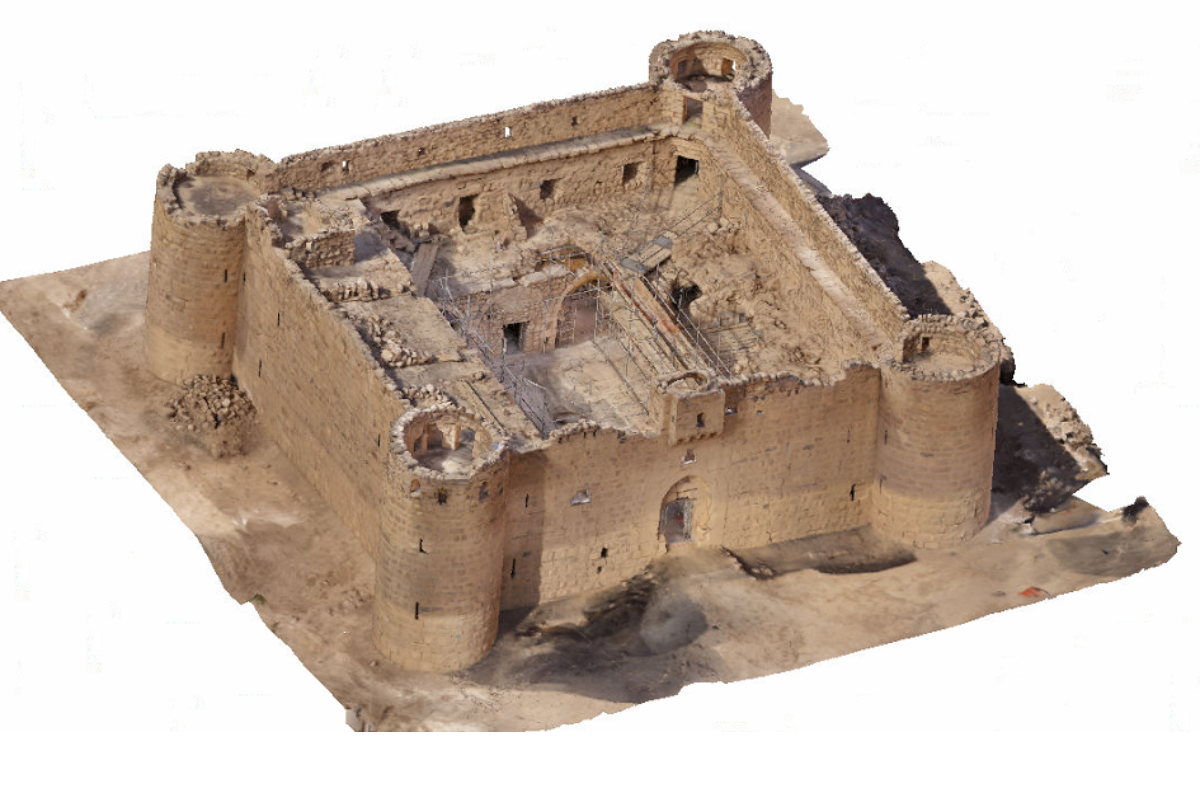
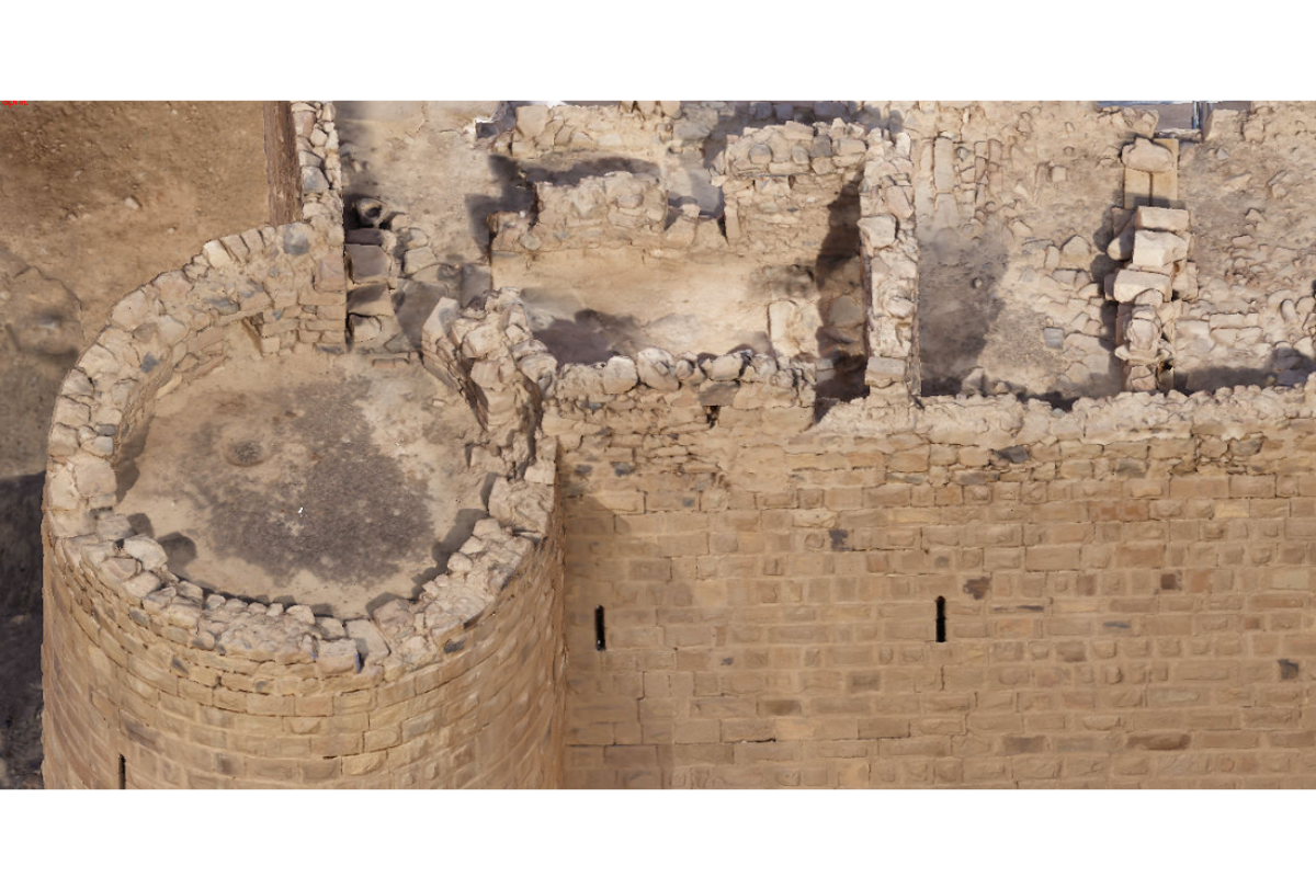
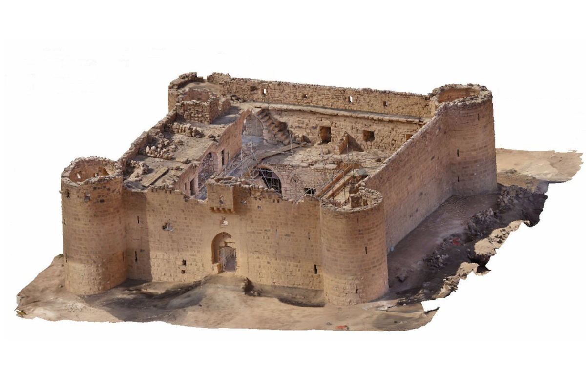
Above: 3D laser scanning provided an accurate geospatial shell and supported evidence for four phases of the fort's development.
Multi-national collaboration
The project achieved results over and above what was expected. This was, in no small part, owing to the collaboration between our team and project partners, RCU and HCC, and local communities. We successfully worked together to not only stabilise the fort, but also to reveal the unexpected complexity of the archaeological remains around the fort.
This was accomplished through clear specifications and management plans, weekly meetings and daily site briefings. Regular and ad hoc inspections were also conducted by RCU – in both their heritage monitoring and health and safety roles.
The groundworks team included people from two continents and as many as five languages were spoken at any one time. Our team spoke some Arabic, and collaborating closely with project partners were able to communicate confidently with people on site and locally, speaking dialects of South Arabia, Urdu, Pashtun, Punjabi and Tagalog.
The project team, including our project partners HCC, were highly experienced working in the local area, which helped to ensure that the works were managed safely in line with Saudi Arabia’s health and safety laws – for example navigating the unexpected discovery of live ammunition among the clearance layers. RCU’s local reach and connections were integrated into the project team allowing us to sensitively manage the remains of the cemetery in accordance with local practices, to avoid delay and foster trusting relationships with local people.
The team also interacted successfully with health professionals, the police, and local people, which is testament to the thought put into the works plans, risk assessments and training.