
I originally started my career as a fieldwork archaeologist but a decade of wind, rain, and snow along with a desire for a new challenge led me into Consultancy. As a Heritage Consultant, I am typically involved at the very early stages of a project, when a client is first commissioning specialist reports to inform a planning application. As part of this, to consider heritage, they will generally need what is called a desk-based assessment to be undertaken.
This desk-based assessment looks at the historic environment as a whole: buildings and historic landscapes as well as buried archaeology. To undertake this assessment, we try and establish the known and potential archaeology and heritage within and adjacent to the site by looking at existing data. This comes from the official records for Designated Assets (e.g., listed buildings, scheduled monuments, registered parks, and gardens), records held at a more regional (generally county) level called the Historic Environment Records (HER) and old maps.
We work with data using Geographic Information System (GIS) software, which allows us to map and interrogate the data, locate and overlay different maps, and create illustrations for the report.
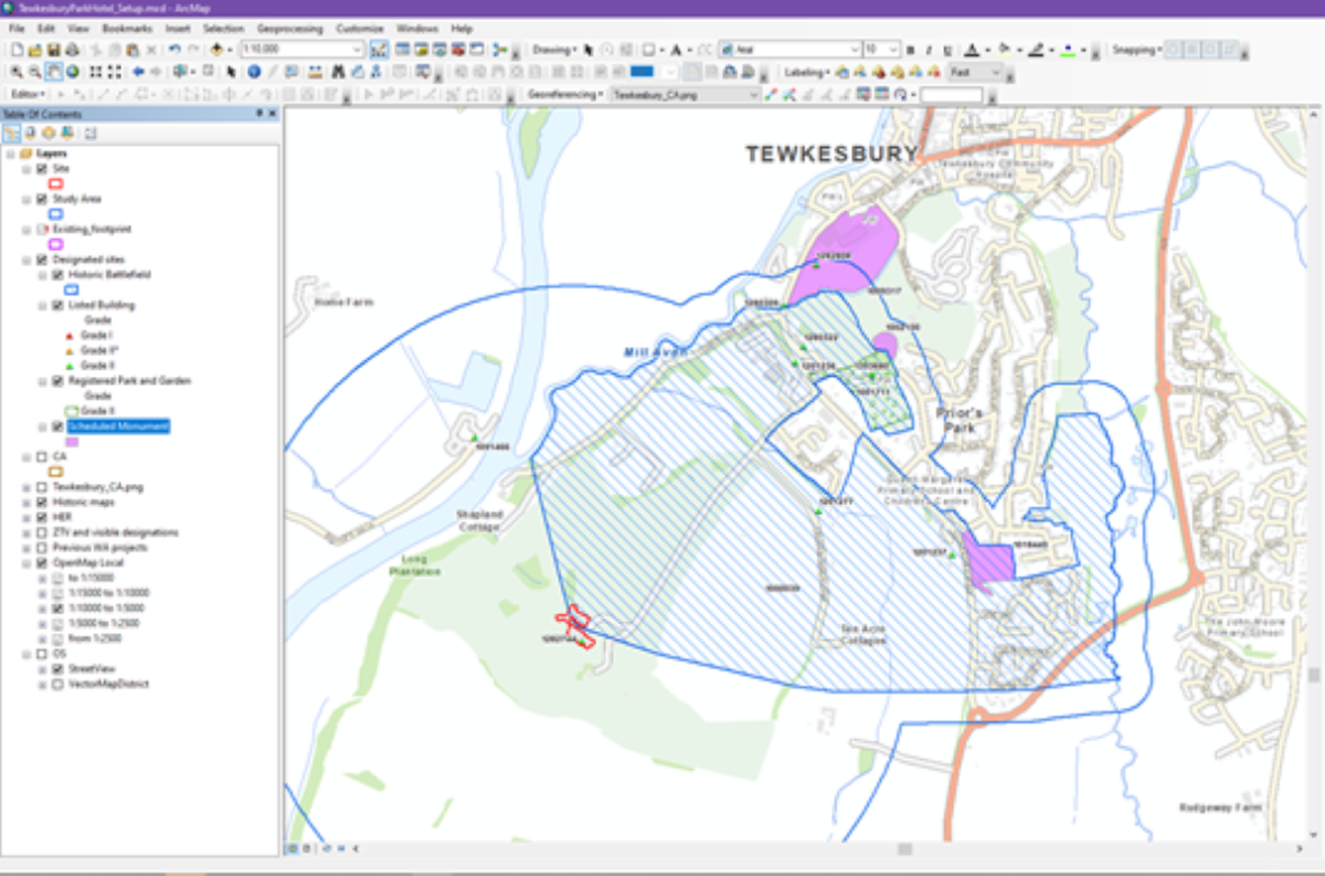
In this view we have designated assets within a study area around a site near Tewkesbury, the study area is normally drawn as a 1km radius around the site, however in this case we have buffered the Registered Historic Battlefield relating to the Battle of Tewkesbury in 1471. If you are interested in knowing what might be near you then you can search on the Historic England website or search Cadw for Wales or Historic Environment Scotland for Scotland
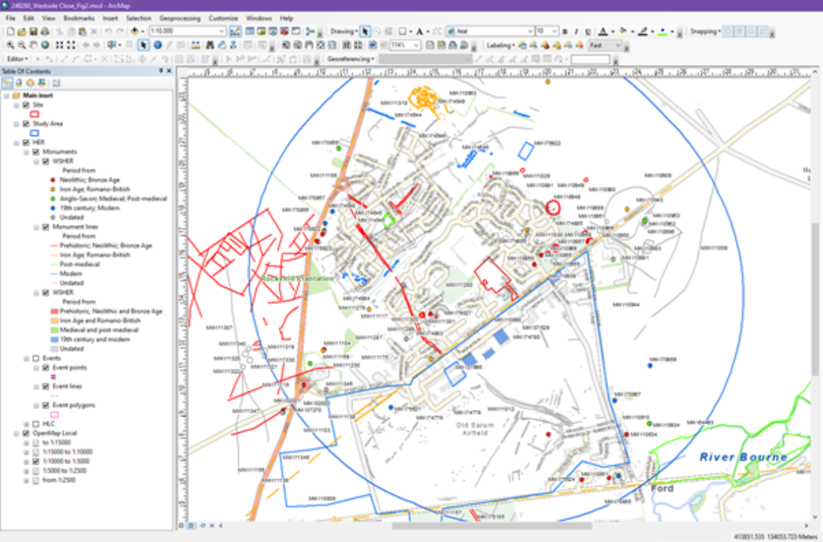
This view shows HER data, we have colour coded it in terms of the date of features, there is everything from prehistoric burial mounds, Iron Age settlement and a former RAF airfield. We request this data commercially and receive it in a format we can use and interrogate through our GIS software, however members of the public can often view a more simplified version of the data online. For southwest England, several regions have made HER data, old maps and other information available through the Know Your Place website
As a Principal Consultant, I am responsible for manging projects and other staff in addition to undertaking assessment work. A typical day for me will involve costing a fee proposal for a potential new client, responding to queries about on-going work, undertaking project admin, such as invoicing, as well as catching up with other staff working on my projects and writing reports.
Although referred to as a ‘desk-based’ assessment, each project also typically requires a site visit. This is a chance to understand the location and topography of a site, to take some photographs for the report and have a quick walkover of the site. There is a potential we might spot some artefacts or earthworks, we might also note historic structures within or immediately adjacent to the site which might need to be considered such as an old barn, milestone, or pillbox.
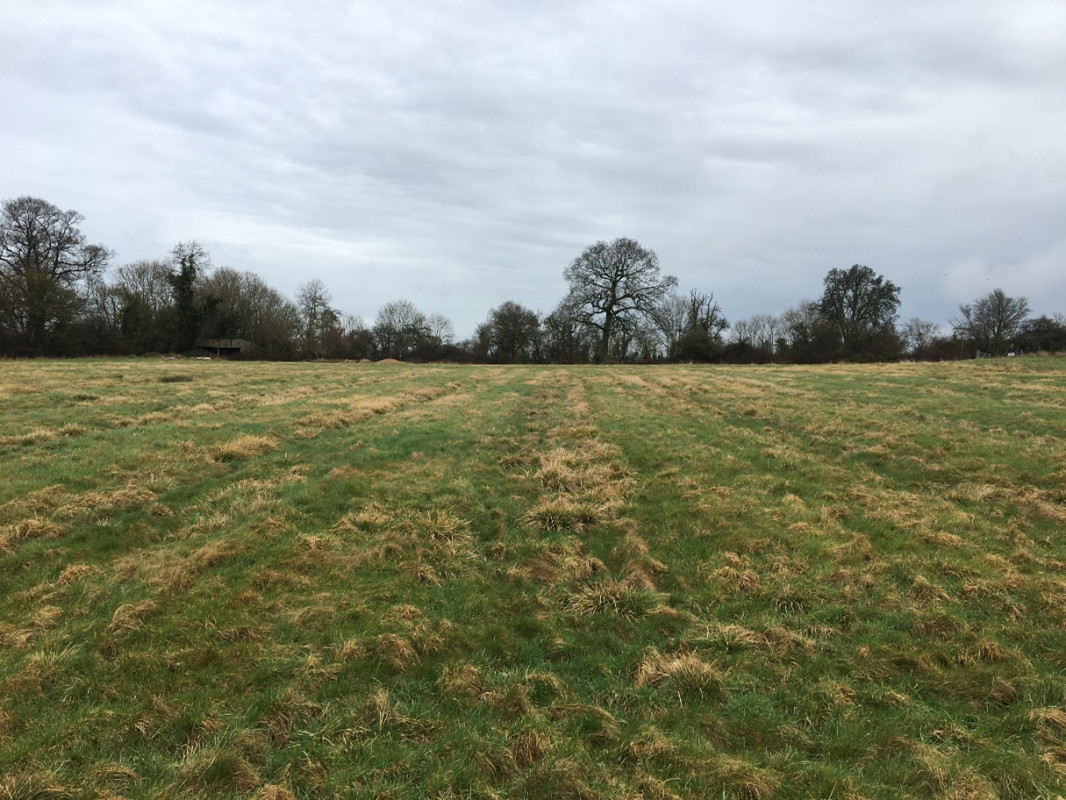
These ridges are ridge and furrow earthworks, their distinctive, slightly sinuous ‘S’ shape is associated with medieval ploughing
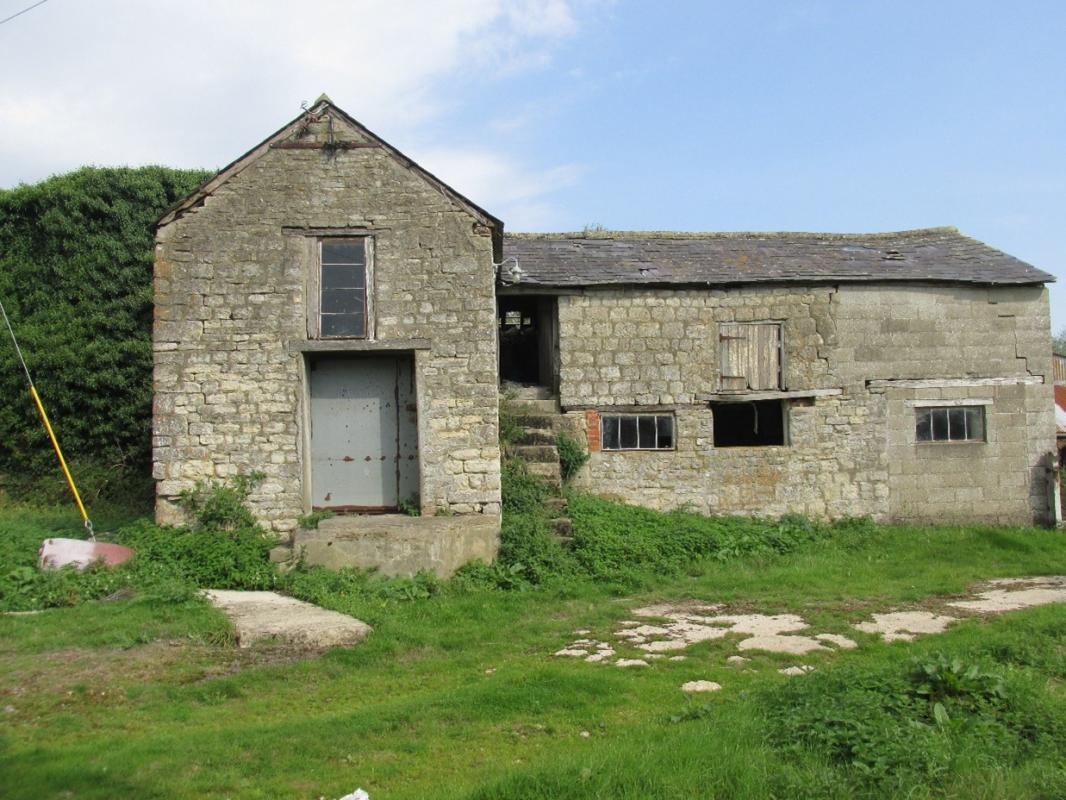
A site visit revealed that the Grade II listed farmhouse wasn’t the only surviving aspect of the post-medieval farm complex as this barn clearly includes older fabric
Another key element of the work we do is considering the issue of ‘Setting’. This is based around the idea that changes to the surroundings of a heritage assets – such as a scheduled barrow, listed medieval church or 19th century landscaped park – can affect our ability to understand and appreciate it. Therefore, we have to consider the impact that an area of new houses, for example, might have on heritage assets in the surrounding area; this can include things like noise, increased traffic as well as visual impacts. The crucial thing to establish is not whether a new development might be seen or heard or experienced in relation to the heritage asset, but whether this affects how we understand it. Changes to the setting of a milestone are unlikely to affect our understanding of it - its ‘significance’ - unless it involved removing or re-routing the road that was associated with it, however a landscaped park set in a rural surrounding might be more sensitive.
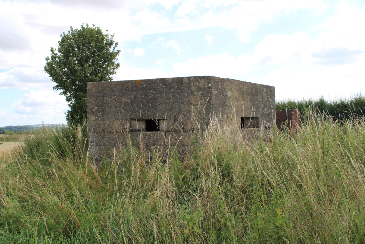
For this World War II pillbox it would be important not to obscure its strategic views along the road it was positioned to defend
An important part of the work we do is using our understanding of the known and potential archaeology and heritage associated with a site to make recommendations for the next stages of work, such as geophysical survey, trial trench evaluation or building recording. Therefore, it’s important for me to talk to my colleagues in other departments to work out what would be the most practical and effective way to approach the next stages. Typically, once the report is finalised, we would discuss it with the archaeological advisor to the Local Planning Authority, the local conservation officer or Historic England (or Cadw or Historic Environment Scotland) as needed to decide on what needs to happen next.
As our work is largely desk-based (apart from the occasional jaunt to site or a record office) it’s easy for us to collaborate and work with colleagues across the country. Modern technology has been really helpful with this, a trend which has only strengthened during the pandemic. From weekly deployment meetings on Teams, to the GIF filled conservation threads, chats, and virtual social nights. This has become an important part of how we work and support each other as a team, something that will continue even as life starts to return to ‘normal’.