
Back in the summer, Wessex Archaeology carried out a geophysical survey of the wreck of the South Australian. The report has been finalised and is now available to all from the Archaeology Data Service here.
The work was funded by a grant awarded from the Honor Frost Foundation by the British Academy. The survey was undertaken for the Ilfracombe and North Devon Sub-Aqua Club (ILFSAC), with the objective of producing a site plan of the wreck site to guide ILFSAC’s future work at the site. Members of ILFSAC have been diving the wreck site since the late 1980s and positively identified the wreck as the South Australian in 2005.
Built in 1868 in Sunderland, the South Australian sank in bad weather in February 1889 in the Bristol Channel, to the north-east of the island of Lundy. The vessel was a clipper ship, similar to the Cutty Sark, and was involved with the emigrant trade between the UK and Australia along with her sister ship the City of Adelaide (now in Port Adelaide, Australia). Later on, the South Australian was used as a cargo vessel and it was on a passage from Cardiff to Argentina transporting railway lines and fish plates (metal plates used to join the ends of two rails together) that the vessel sank.
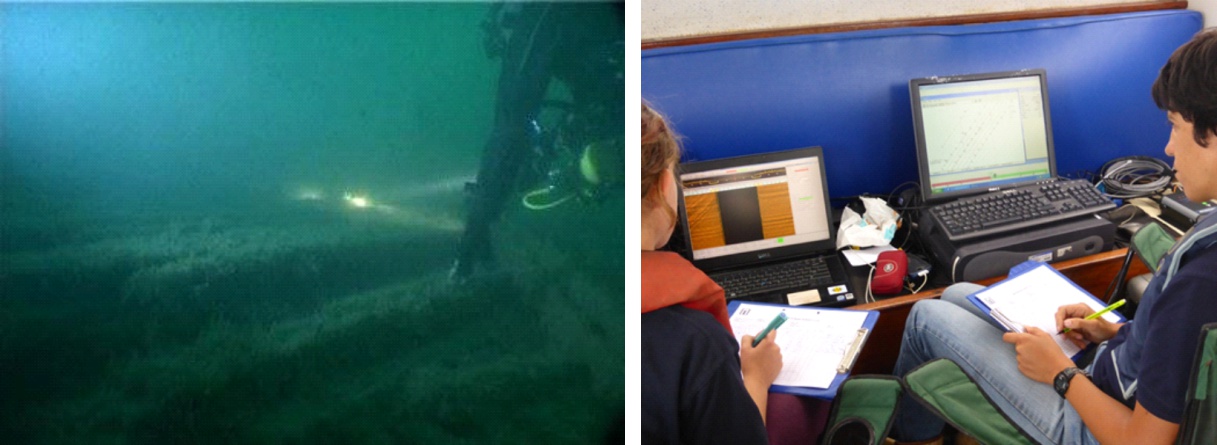
The geophysical survey was conducted aboard ILFSAC’s dive boat Neptune on the 23 July 2015 by Stephanie Arnott and Laura Andrews of Wessex Archaeology. They were ably assisted by Keith Denby, Shaun Galliver, Piers Biddle and Richard Howell, all of ILFSAC. Sidescan sonar data were collected over the wreck site in an area measuring 200 m x 200 m.
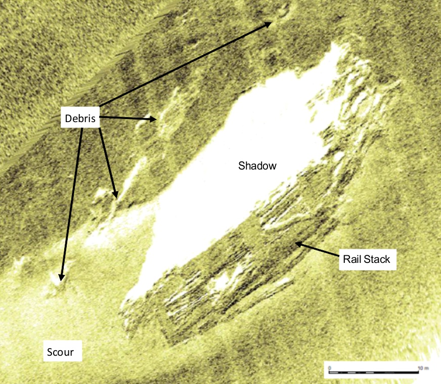
The bulk of the wreck site consists of a stack of railway lines, clearly visible in the geophysical data. The hull has collapsed and little now remains of the vessel. A large scour extends to the west of the wreck site. Adjacent to the rail stack is a debris field containing parts of the wooden hull. In the geophysical data a number of individual items of debris are seen. The majority of these features are not known to the divers and will provide targets for future investigations.
The site plan produced will be edited and new information added as it becomes available. All features seen in the geophysical data are indicated on the plan along with the approximate positions of items found by the divers, where these are known. Some objects discovered by the divers, such as two anchors, do not have accurate locations associated with them and these will need to be dived again, related to the objects nearby and then added to the plan.
The results of this successful collaboration between Wessex Archaeology and ILFSAC will support ILFSAC’s aims to inform local communities about the maritime heritage on their doorstep and provide information for visitors to Lundy about the wreck of the South Australian. In addition, ILFSAC will be in contact with the Maritime Museum in Adelaide to exchange information that will aid both groups in understanding and preserving the history of both the South Australian and the City of Adelaide.