Marine aggregate dredging in the UK has a commercial history stretching back to the 1700s. The industry in its modern form has its origins dating to the 1920s but it is since the 1960s that it has made an increasing contribution to UK aggregates supply. A system of nationally managed aggregate supply has been in operation since the 1970s to ensure the adherence to planning policies at local and regional levels. There are seven regions of aggregate extraction areas situated in the North Sea, Irish Sea, English Channel and Bristol Channel.
Aggregate License Area 430
In 2006 Wessex Archaeology undertook a desk-based assessment in support of an aggregate licence renewal application for Area 430, on behalf of the licensees CEMEX UK Marine Ltd and Volker Dredging Ltd. Area 430 is situated approximately 24 km east of Southwold, Suffolk, in the southern North Sea. Topographical, geological, sea-level and archaeological data were combined to allow an assessment of the archaeological potential including in situ or derived Palaeolithic and Mesolithic artefacts, and wrecks and related material, from prehistoric to modern times. This proved to be so, less than a year later.
Recovered Archaeology
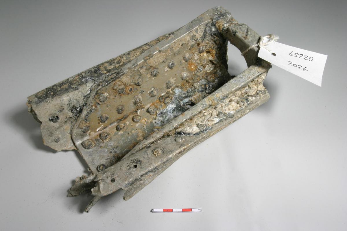
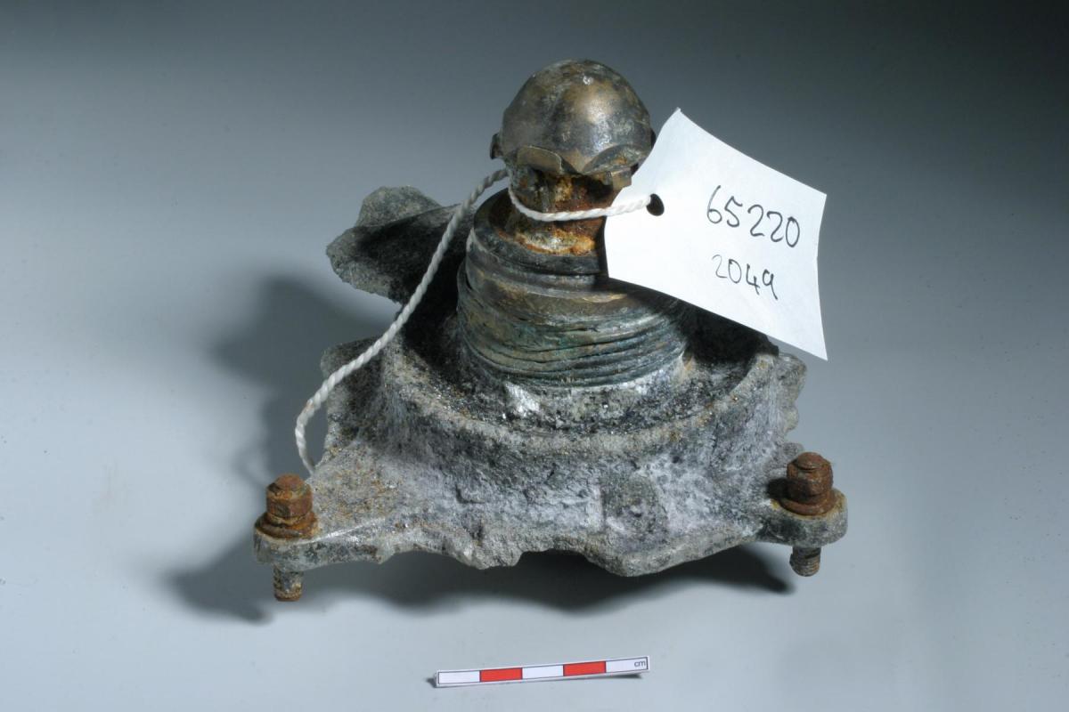
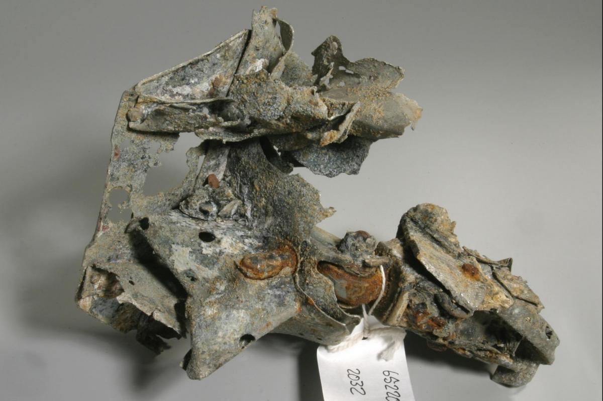
In January 2007, over 300 fragments of aircraft wreckage and a human arm bone were discovered at Ridham Wharf in aggregate dredged from this area and where reported through the Marine Aggregate Industry Protocol for Reporting Finds of Archaeological Interest. Historic England and the Ministry of Defence Joint Casualty and Compassionate Centre (JCCC) were immediately informed of these finds and a Temporary Exclusion Zone (TEZ) was accordingly instigated in the area, delineating a no-dredge area. The TEZ initially covered approximately half of the Licence Area, based on where dredging activity had taken place during the period from which the artefacts were recovered. Further investigation, based on 87 diagnostic pieces of material, identified the wreckage as most likely that of a German Junkers Ju 88, probably lost during the Battle of Britain during the second half of August 1940.
Our Approach
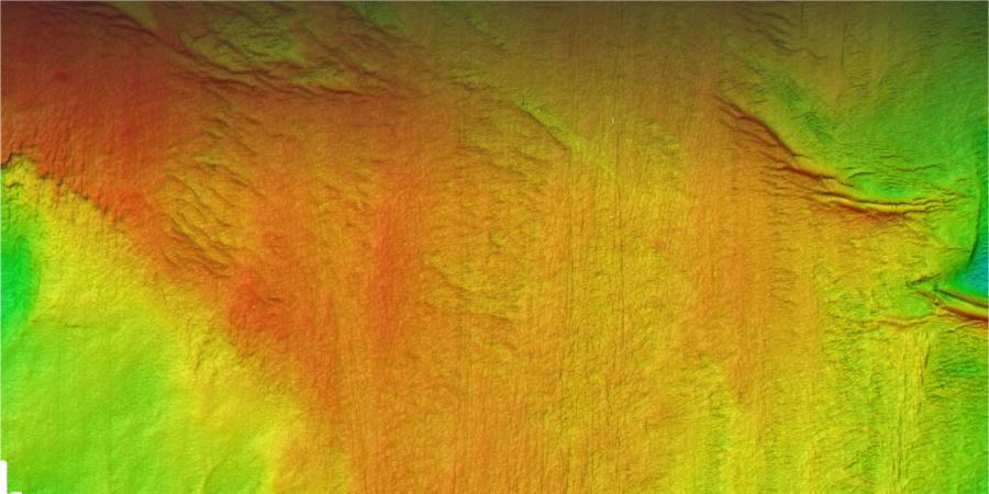
To reduce the size of the TEZ further assessment of both existing geophysical data was undertaken. This allowed a slight reduction in the size of the TEZ but to further mitigate the cultural resource, we undertook a high-resolution geophysical survey, acquiring high frequency sidescan sonar data and magnetometer data. The resultant formalised Archaeological Exclusion Zone (AEZ) was subsequently limited to just 2.4% of the original TEZ allowing the remainder of the TEZ to reopen to dredging.
Subsequently, monitoring of the site and AEZ have continued as part of the licence conditions for the area to ensure that the AEZs are adhered to and no further archaeology has come to light. Wessex Archaeology undertook the monitoring assessments of geophysical data acquired in 2010, 2014 and 2016.
Although the recovery of such material, in such volume, is relatively rare, the work undertaken at Area 430 highlights how a combination of desk-based assessments and protocols for archaeological discoveries can provide mitigation responses which benefit the protection of submerged cultural heritage, while providing for the most efficient use of the Licence Area by dredging companies.