Wessex Archaeology’s world-leading marine geophysicists specialise in providing reliable archaeological interpretation and classification of marine geophysical data. Our marine geophysicists provide group technical authority and subject matter expertise both internally and to our stakeholder base through commercial advice and outreach.
What is marine geophysics?
Marine Geophysical Survey is a collective term for non-invasive, remote-sensing techniques which can be used to investigate the physical characteristics of the Earth.
Marine geophysics for archaeology uses these same techniques to identify anomalies which may represent underwater objects or features of possible archaeological significance, either buried or on the Earth’s surface. These methods can be used in river, coastal, intertidal and marine environments.
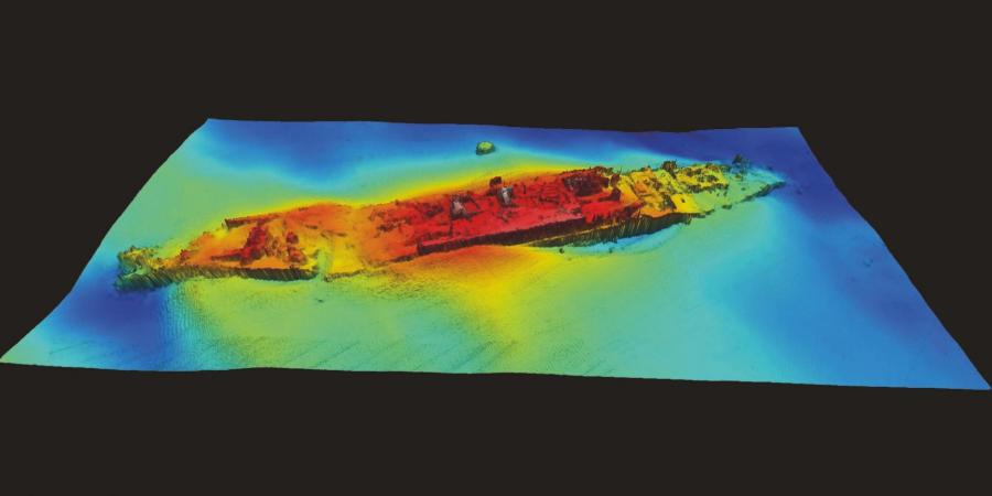
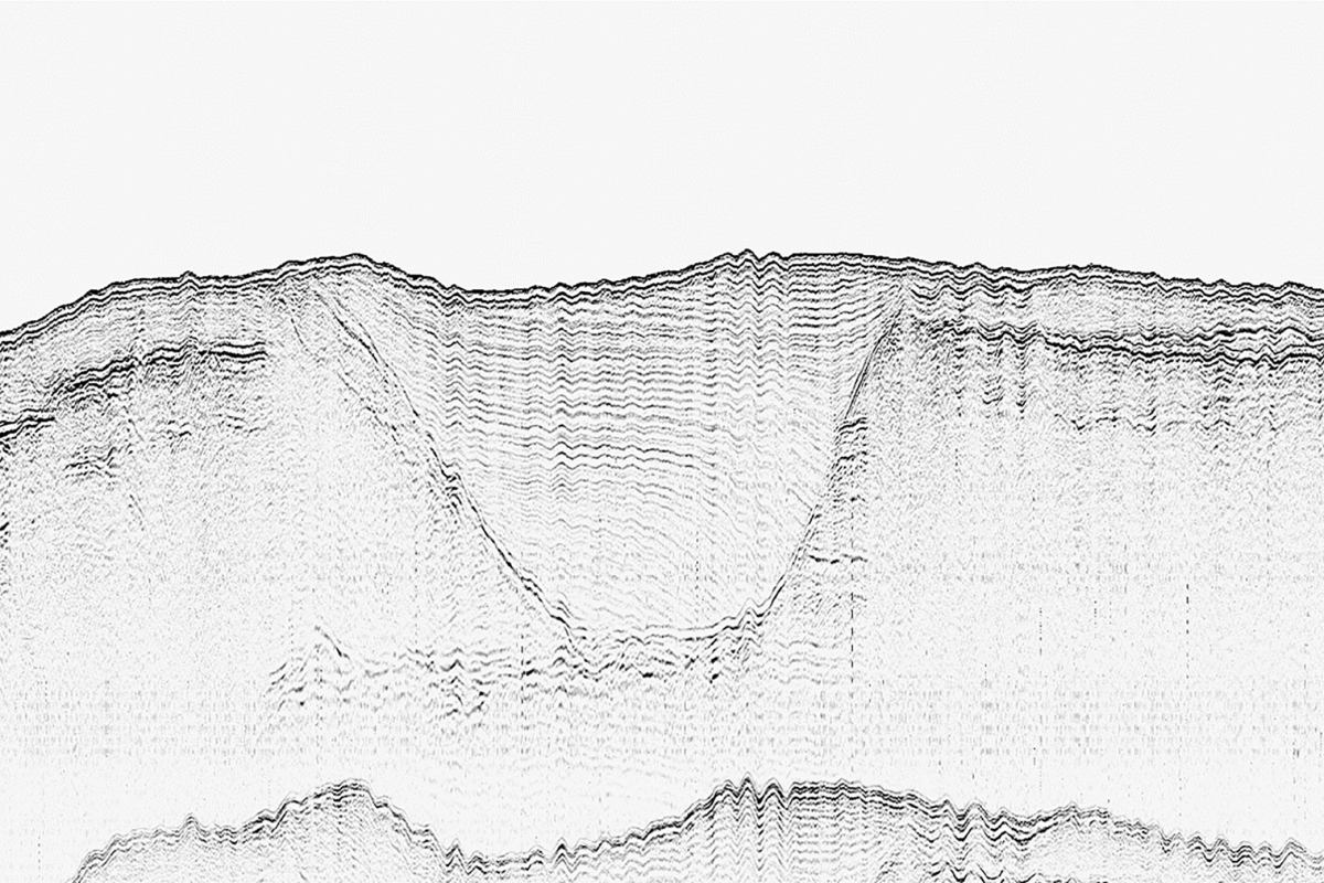
At Wessex Archaeology, we provide archaeological assessment for a comprehensive range of marine survey methods including sidescan sonar, marine magnetometer, multibeam bathymetry and sub-bottom profiler techniques.
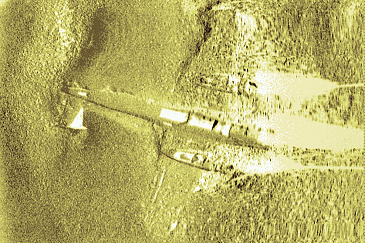
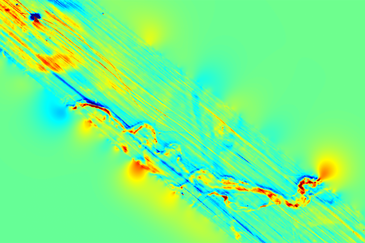
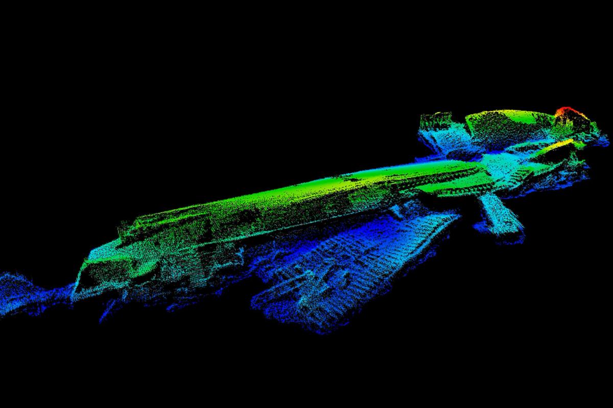
These datasets are interpreted to identify the presence or absence of marine cultural material, such as ships and aircraft wreck sites; discrete anthropogenic debris on or below the seabed; and submerged palaeolandscapes.
Who needs marine geophysics?
Marine geophysical assessments are an efficient, non-intrusive and cost-effective method of assessing the archaeological potential of the marine and transition-zone environment ahead of development works or as part of a research project.
We have extensive national and international experience in providing effective risk management for planning requirements. Our projects range in size from individual wreck sites to extensive Offshore Wind Farm developments.
Our marine geophysicists work with clients in various sectors and industries including:
- energy and renewables: (offshore wind, tide and wave);
- extractive: minerals, oil and gas, and aggregates;
- transmission: submarine power communications cables and pipelines;
- infrastructure: port, harbour development;
- flood management: inshore waterways, shoreline reclamation and stabilisation
- regulatory: government heritage departments, wreck monitoring
- community engagement: STEM, local voluntary and academic research groups
When does marine geophysics add value?
As a non-invasive set of techniques, marine geophysical surveys, their processing and interpretation, leading to assessment and classification, can add value and reduce risk throughout the life of project (LoP). They represent a cost-effective means to demonstrate compliance to consenting to the whole 360 stakeholder mapping.
Wessex Archaeology has a track record of providing retained archaeology services for the LoP and it is usual to address the marine geophysical data at each stage.
Taking offshore wind farms and renewables as an example, Wessex Archaeology is a partner for projects from the scoping stage, establishing the EIA baseline, providing assessments post-consent and pre-construction, monitoring for scour during operations and we expect to partner through decommissioning and repurposing.
What are Wessex Archaeology’s capabilities?
Marine Geophysical Acquisition
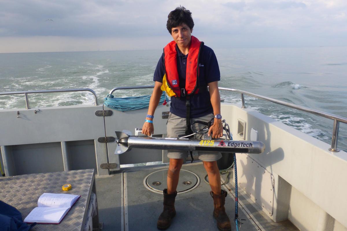
- undertaking small-scale geophysical surveys where archaeology is the primary objective (such as wrecks), including sidescan sonar, marine magnetometer and sub-bottom profiler surveys;
- advising on technical specification for surveys;
- collaboration with other survey companies to acquire multibeam bathymetry data and geophysical data over larger scale areas; and
- offshore client representative for archaeological surveys.
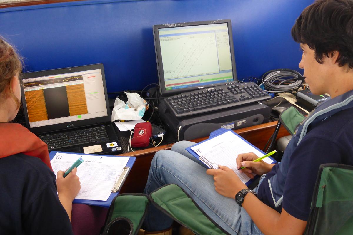
Marine Geophysical Interpretation
- archaeological interpretation of geophysical data for coastal and offshore developments, including data acquired for archaeological, geological and geoarchaeological, engineering or unexploded ordnance (UXO) assessment;
- review of third-party geophysical data and interpretation;
- monitoring implementation of Protocols for Archaeological Discoveries (PAD);
- post-consent support.
Marine Geophysical Assessment of archaeological significance
- assessing archaeological significance of geophysical anomalies based on multi-physics datasets;
- assigning archaeological discrimination to all geophysical anomalies regarding archaeological significance;
- classification of all geophysical anomalies with anthropomorphic potential within a project area; and
- mitigation and risk management
- contributing to pre-application advice, scoping reports, desk-based assessments (DBAs), Environmental Impact Assessment (EIA), Environmental Statement (ES), and Written Schemes of Investigation (WSIs);
- scientific reporting of archaeological potential;
- providing archaeological mitigation strategies based on geophysical interpretation including micro-siting by ROV and diver survey, and implementation of and archaeological exclusion zones.
Community engagement and work experience opportunities
- collaboration with community projects;
- teaching resources;
- talks and conference presentations;
- work experience placements.
Our Marine Geophysics Team
Wessex Archaeology’s team of experienced geophysicists is the largest in the UK. With a range of backgrounds including archaeology, geology and geophysics, our highly qualified multi-disciplinary team undertake all aspects of geophysical data acquisition and assessment, and we pride ourselves on the high quality we deliver.
Team


Environmental Impact Assessments and Cultural Heritage Chapters
Marine and Maritime Archaeology and Cultural Heritage Services
Marine Digital 3D Survey
Marine Geoarchaeological Assessment
Heritage Consultancy
Historic Environment Management
Coastal & Intertidal Fieldwork
Collaborative Research
Community & Education
Post consent marine archaeology
Archaeological assessment (interpretation) of geophysical datasets
Sidescan sonar
Marine magnetometer
Multibeam echosounder (bathymetry)
Sub-bottom profiler
Offshore client representative for archaeological surveys
Advice on survey specifications
High resolution marine archaeology geophysical surveys
Data Quality Control and data management service

Get in touch
Contact Louise Tizzard, Data, Innovation & Technology Director