Reducing costs
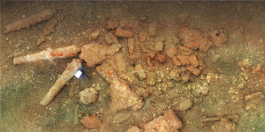
We use georeferenced 3D photogrammetry for pre-disturbance surveys, making Remotely Operated Vehicle and diver interventions more efficient and therefore less costly. We also have the expertise to apply this technique to photographic and video data acquired during unexploded ordnance assessments and other non-archaeological surveys. This avoids the need to return to unexpected archaeological discoveries for additional expensive work.
Georeferenced 3D photogrammetry is extremely useful for archaeological sites in the intertidal zone, where the survey time available is often very short, and for recording large objects found during dredging and other works.
The Marine Digital 3D Survey Team
As well as expert staff, Wessex Archaeology has a full suite of photographic equipment suitable for underwater 3D mapping, together with comprehensive survey equipment for georeferencing. Our powerful workstations and software mean we can process data quickly, both in the office and in the field.
Team


3D outputs & dissemination