Our multi-disciplinary team specialising in submerged palaeolandscapes research has been at the forefront of this emerging field for over 25 years. With experience producing work for commercial, consenting, and research purposes, we have a long-established portfolio of commercial projects.
We have worked in the North Sea basin, in waters around the UK and Ireland, Australia, the Gulf of Mexico, as well as conducting extensive research across the Mediterranean and Baltic Seas. This portfolio spans prehistoric archaeological evidence from the Lower Palaeolithic to the Mesolithic periods, relating to activity by modern humans, as well as Neanderthals and other extinct early human species.
What are palaeolandscapes and why are they important?
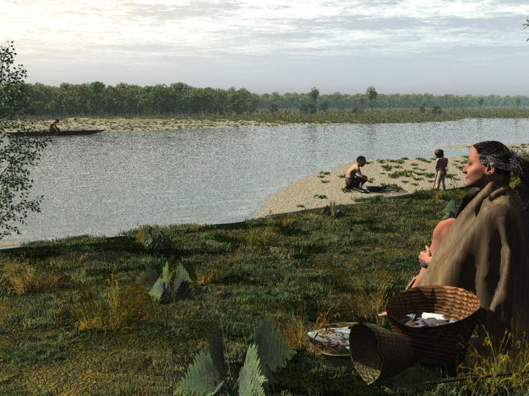
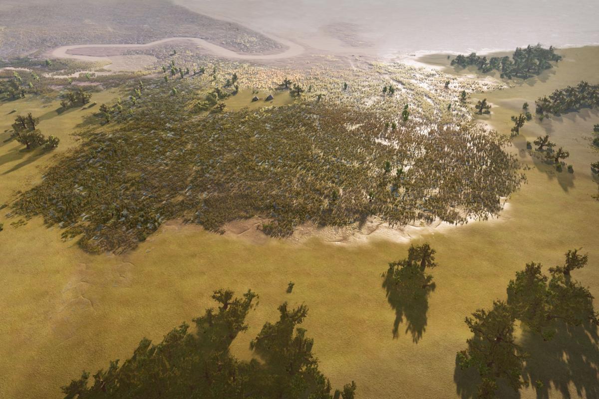
Palaeolandscapes are past terrestrial and coastal landscapes that formed during periods of lower sea level. These palaeolandscapes have since become submerged by sea-level rise, preserved at today’s seabed or beneath marine sediments. Palaeolandscapes may have been inhabited by early humans. The archaeological and palaeoenvironmental remains of these people are incredibly rare and allow us to understand significant information, often not evidenced on land, about past humans and the landscapes they lived in.
Our knowledge and understanding of submerged palaeolandscapes is growing thanks to increasing data coverage gathered from marine development and major scientific research programmes around the world.
What are Wessex Archaeology’s capabilities?
Submerged palaeolandscapes research involves a range of technical and archaeological experts working on specialist data interpretation. Key data our experts specialise in include:
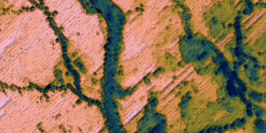
Marine geophysical data - specifically seismic reflection (especially Ultra-High Resolution Seismic, UHRS), Sub-Bottom Profiler (SBP), and bathymetry data from various sources (Multibeam Echosounder (MBES), LiDAR, satellite).
Geotechnical data and sediment samples - such as core logging, borehole wireline logs, and Cone Penetration Tests (CPTs).
Archaeological and palaeoenvironmental records
Our unique suite of technical capabilities allows us to deliver products that inform Environmental Impact Assessments (baseline understanding and receptor identification), conservation management plans, research frameworks, technical guidance, and other commercial and research products. The outputs from these submerged palaeolandscapes studies can be tailored to project-specific needs, but typically include:
- Maps and databases of interpreted submerged palaeolandscapes features;
- Detailed descriptions of seismic units, sedimentary facies, and combined depositional environments;
- Stratigraphic frameworks of the Quaternary geology, including deposit models and transects;
- Geoarchaeological models of palaeolandscape evolution;
- Palaeoenvironmental assessments of geotechnical sediment samples, micro- and macro-fossil analysis and palaeoenvironmental reconstruction;
- Environmental Impacts Assessments and development of mitigation strategies;
- Assessment of potential material culture and intangible cultural heritage;
- Digital artistic reconstructions combining palaeoenvironmental, archaeological, and palaeolandscape data.
Our submerged palaeolandscapes team
Our large, inter-disciplinary team works across the globe and is composed of marine geoscientists, geoarchaeologists, and maritime archaeologists. Our experts have decades of commercial experience and strong academic records. This extensive expertise ensures that our services support our clients to successfully achieve consenting and marine development goals efficiently, whilst maximising research value, scientific knowledge, and public engagement with our past landscapes.
Team