As another week passes, we arrive in the Market Place, the trading hub of the medieval city and still, twice weekly, the home, since 1227, of the Charter Market. For those of you who know the city, this large open space was originally much bigger and extended from the south side of New Canal to include the area around St Thomas’ Church; medieval infilling including Fish Row, Butcher Row and Oatmeal Row reduced it to its present size. The provision of large open space formed a vital point at the commercial heart of the city and also formed a natural location for the principal civic buildings. The Bishop’s Guildhall was an imposing building which stood where the Guildhall now stands and represented the bishop’s authority within the city from the early 14th century. A Council House, for secular administration, followed in the 15th century. This was originally built at the west end of the Market Place but was subsequently rebuilt at the east end in the early 1580s, near where the war memorial now stands. This building, for which we have no precise footprint, was probably built on stone or flint foundations. Illustrations show it with a timber frame of three stories, open colonnades at the sides and a central turret. It was seriously damaged by fire in 1780, after which it was agreed to amalgamate the Bishop’s Guildhall and the Council House in a single Guildhall, which still forms the principal civic building in the city. Despite the importance of the area few archaeological opportunities had presented themselves to establish whether any traces of these earlier buildings survived.
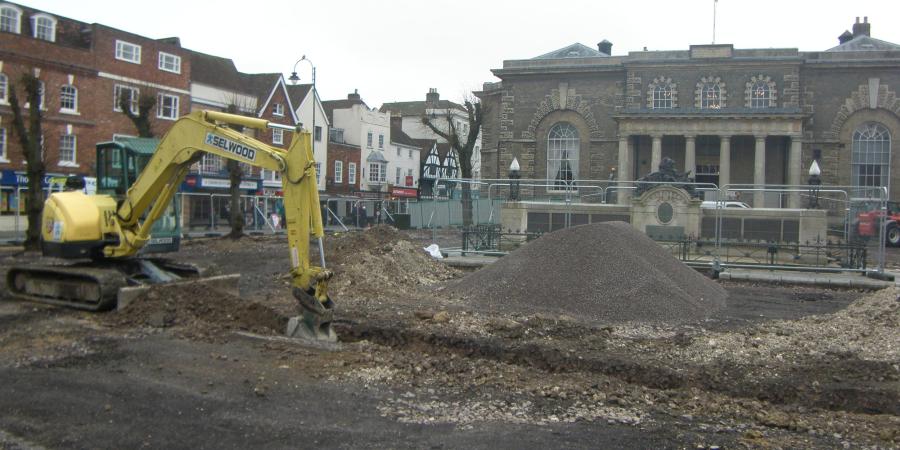
This omission was partially remedied in 2013 when the Market Place was extensively refurbished. Expectations were limited, the groundwork did not require any deep trenches; nevertheless, there was optimism that earlier foundations might be exposed where drainpipes were due to be installed. This was confirmed in a slot at the front of the present Guildhall which revealed a short length of a brick foundation, which, it was thought, probably formed part of a boundary wall surrounding the Old Council House.
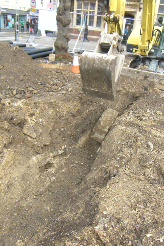
A much more unexpected discovery was made in the north-east corner of the Market Square where an L-shaped pipe trench exposed part of a solid foundation, which was built of neatly jointed blocks of Chilmark limestone. The foundation could be traced for approximately 7m from east to west and continued beyond the limits of trenching. The base was reached approximately 1.5m from the existing ground surface, and it survived to a height of between 0.5 and 0.75m. Blocks of Chilmark limestone from the demolition were scattered all around.
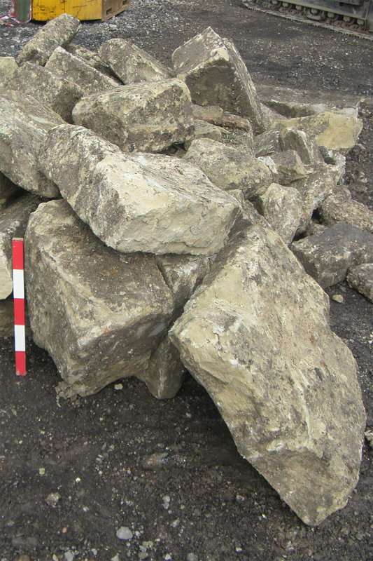
Blocks of Chilmark limestone from the demolition of the foundation structure, seen within the excavation trench and after excavation
Two explanations for this foundation are prominent. It may represent a long-lost remnant of the Council House, about which so little is known; however, it seems more likely that it formed part of a bridge which crossed the network of water channels flowing through the city. If so, it represents the first occasion where traces of one of these crossing points has been found. John Speed’s map of Salisbury, which was compiled in 1611, although very stylised, clearly shows bridging points at crucial junctions in the system, as here, where a channel flowing from Blue Boar Row into Winchester Street crossed a channel linking Endless Street and Queen Street.
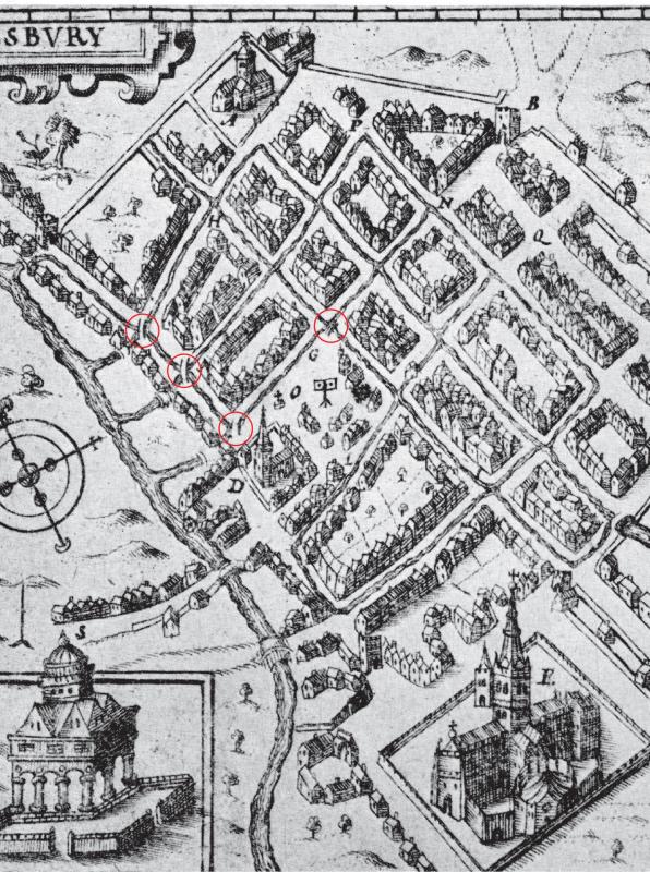
An extract from John Speed’s plan of Salisbury c.1600. The bridges are circled in red
Naish depicted the same bridging points by pairs of diagonal lines, in his survey of 1716. The complex network of water channels was a novel idea and a testament to medieval engineering and water control. It offered many advantages; however, it also created problems, not merely the transmission of disease, but also in communication, especially when distributing livestock and vehicles around the city. Prints and paintings show that narrow footbridges were available for agile pedestrians, but these were unsuited to the transfer of more substantial cargos which required larger load-bearing structures.
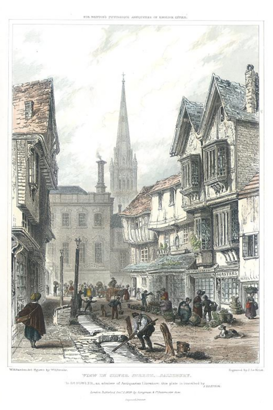
View in Silver Street, Salisbury 1829, engraving by J. LeKeux after W. H. Bartlett and W. H. Brooke (courtesy of antiqueprints.com)
Very little is known about when the bridge was built, but it is unlikely to have formed part of the original layout of the channels. This suggests it was a late medieval or early post-medieval replacement for an earlier bridge. Its demolition may have taken place in the 1850s when the watercourses were made redundant and backfilled.
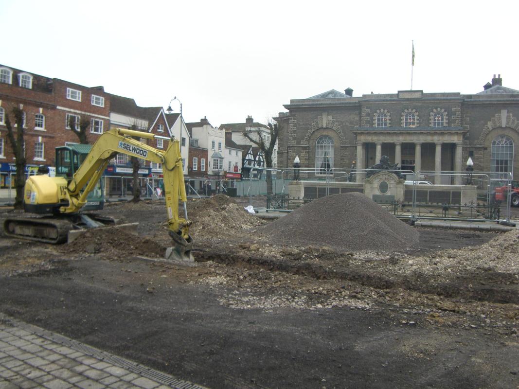
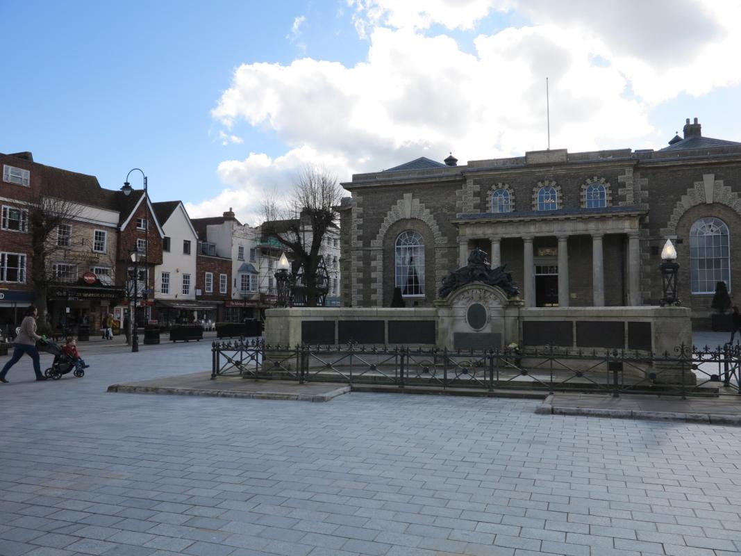
The Salisbury Market Square site during excavations in 2013 (left), and today in 2020 (right)
This small project fully justified its commission. It revealed only limited physical remains of the civic buildings it was designed to locate, but uncovered traces of a previously overlooked part of Salisbury’s rich archaeological past.