A New Road for South Yorkshire
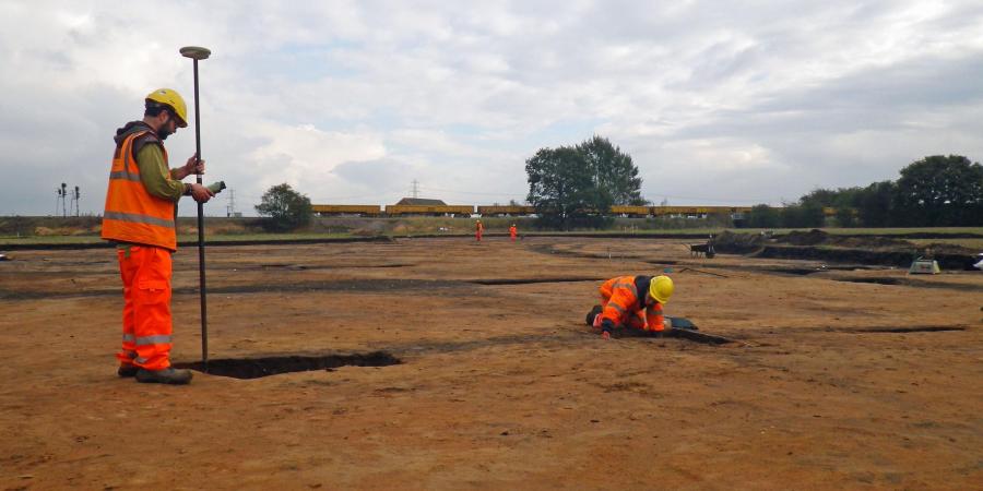
Between 2012–2014 staff from Wessex Archaeology’s Sheffield office undertook investigations along the 4.5 km-long course of a new road near Rossington, South Yorkshire. The road, which was known as the Finningley and Rossington Regeneration Route Scheme during construction but was rebranded as the ‘Great Yorkshire Way’ following its 2016 opening, was constructed to improve access to Doncaster Sheffield Robin Hood airport and unlock development sites along its course.
Working for Mott MacDonald Ltd on behalf of Doncaster Metropolitan Borough Council, Wessex Archaeology initially undertook geophysical survey, fieldwalking and evaluation trenching to investigate potential archaeological remains along the route, with the survey results forming part of the Environmental Impact Assessment for the scheme.
The initial surveys identified seven likely sites, which were then investigated by open area excavation.
The Ancient Landscape
Along the western part of the route (Areas 1 to 4) Iron Age and Romano-British field boundary ditches, enclosures and a waterhole were recorded. Within Areas 5 and 6, old field boundaries were also present, although these were of post-medieval or modern date. Area 7 contained an undated hollow-way and gully.
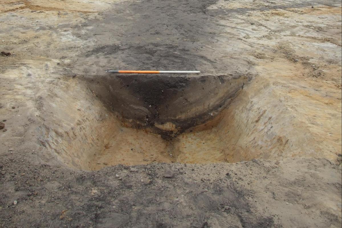
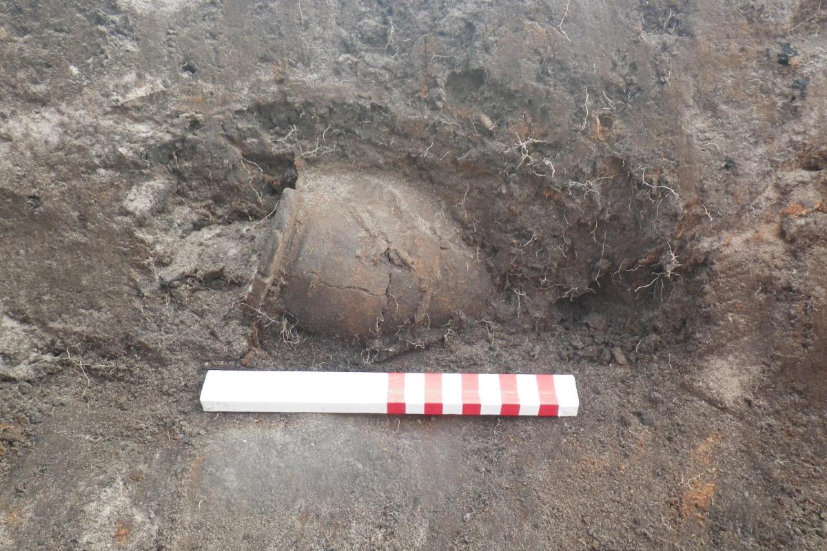
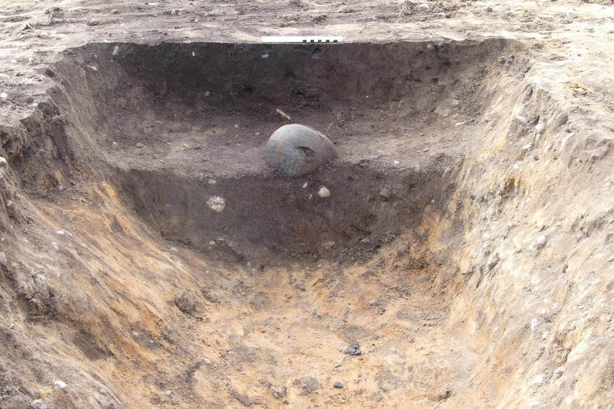
Areas 3 and 4 proved to be of the greatest archaeological interest, containing as they did a Romano-British enclosure set within a field system seemingly established in the Late Iron Age. The Roman remains mostly dated to the 2nd and 3rd centuries AD, with pottery assemblages dominated by local grey wares, with smaller quantities of samian, Derbyshire ware and shell gritted wares, perhaps brought from the ‘Trentside’ kilns of Lincolnshire or Nottinghamshire. None of the pottery suggests any continuity of activity into the 4th century AD. A fragment of a dish, possibly produced by military potters based at Lincoln and dating to the middle of the 1st century AD, was recovered from the base of a waterhole that pre-dated the field system. This relatively early and unusual artefact may have been an ‘heirloom’ object deposited some time after it was produced, or may reflect activity on the site not long after the arrival of the Romans. The item was probably linked to the Roman fortress at Rossington (4 km to the east) and may have been a gift from the military to local native leaders.
The landscape remained agricultural throughout the medieval period, with the majority lying within extensive former wetland commons. The existing layout of large fields divided by hedges and deep drains largely came into being with the 17th-century improvement works undertaken by Dutch engineer Cornelius Vermuyden.
Environmental Archaeology
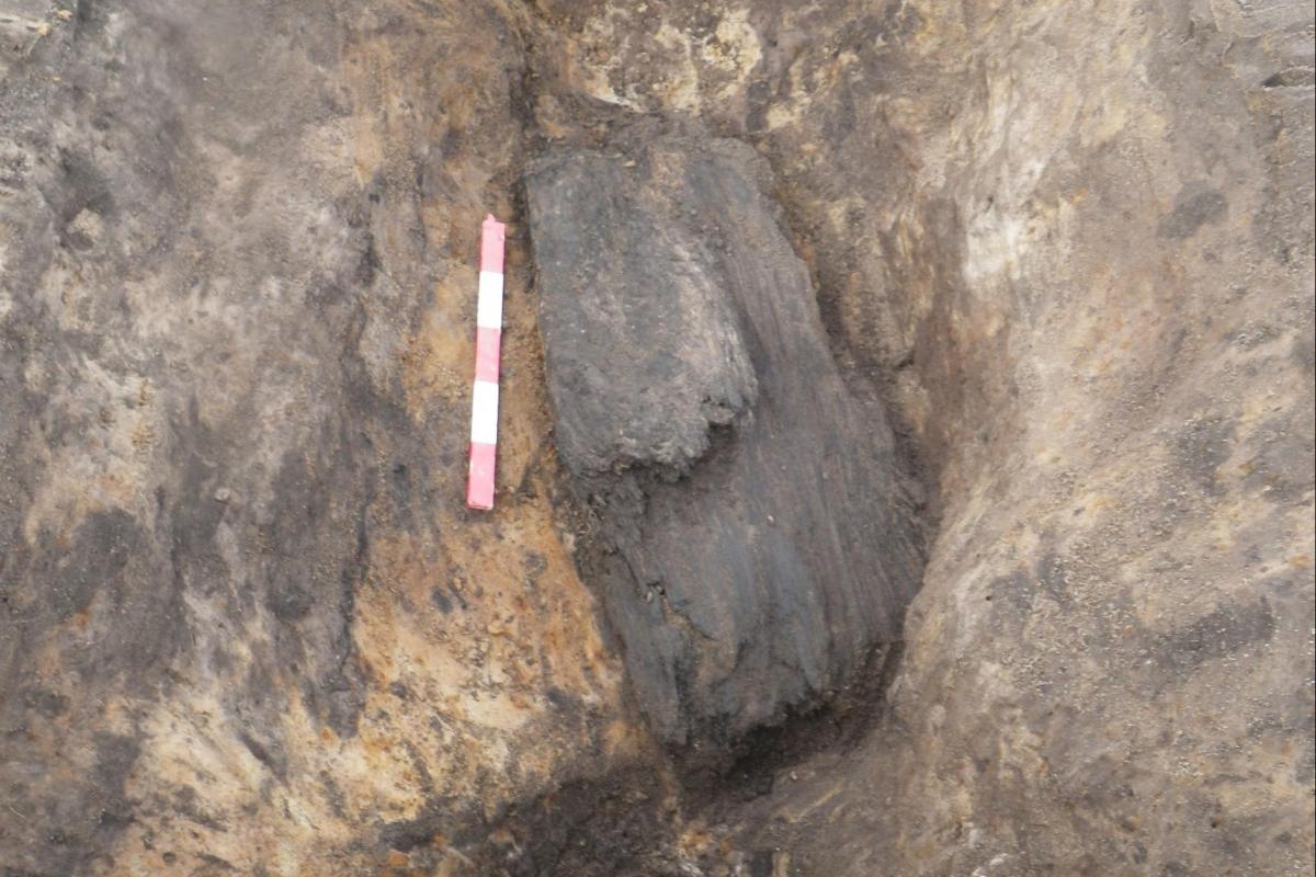
Plant remains reveal that during the Late Iron Age and Roman periods the area comprised wet grassland, scrubby vegetation and alder carr and mixed deciduous woodland. Inhabitants of this damp floodplain environment supported themselves through animal husbandry and the cultivation of arable crops (spelt wheat, emmer wheat and barley).
Of particular interest was an infilled watering hole, which radiocarbon dates indicate was in use during the later Middle or Late Iron Age and had gone out of use during the early Roman period. Pollen from the waterhole suggests a more wooded landscape at the end of the Iron Age, with samples dominated by oak, birch, elm, lime, alder and hazel. In addition, evidence of grasses, herbs and cereals was also present.
The feature, which was cut by a Roman enclosure, contained the enigmatic dish mentioned above, and may provide evidence of the re-establishment of woodland at the end of the Iron Age, before further clearance of the land for agricultural use during the Roman period.
Broader Context
The area around Rossington is well known for containing cropmarks of extensive ancient field systems, with many of these first found and photographed from the air by Derrick Riley in the 1970s and 80s. The construction of the new road and the linked development of the Doncaster iPort distribution park (with which Wessex Archaeology has also been involved) have provided an exciting opportunity to examine these cropmarks in greater detail. It has been possible to establish the date of these field systems, come closer to the people who created and farmed them, and gain more information about the development of their ancient landscape.
A summary of the results from the roadscheme will be published in the Yorkshire Archaeological Journal, and the full report can be read or downloaded below: