The Dorset Coast Historic Environment Survey grew out of the work of the Archaeology Group (AG) of the Dorset Coastal Forum (DCF). The AG realised that little was known about the condition of historic buildings and archaeological sites along much of Dorset’s coast and how vulnerable they were to changes to the coastline. A proposal for a Historic Environment Survey for Dorset was put forward to English Heritage. The primary aim of the survey is to increase our knowledge of Dorset's coastal built and archaeological heritage, and hence facilitate its better management and greater enjoyment by local people and visitors.
Wessex Archaeology began work in September 2003 concentrating on a survey area agreed with DCC and English Heritage. The area extends for a kilometre inland from the coast and offshore as far as the six mile fishing limit.
Wessex Archaeology has also been commissioned to draft a Dorset Coast Historic Environment Research Framework. This consultation document is available to download as an Adobe PDF.
A short leaflet outlining the work of the Dorset Coast Historic Environment Survey is also available to download (Adobe PDF).
View the online Exhibition.
Objectives
Wessex Archaeology’s work on the Dorset Coast Historic Environment Survey is an integral part of the Dorset Coast Strategy (Adobe PDF). The strategy’s foremost concern is the long-term conservation of the Dorset coast’s geological, wildlife, landscape and archaeological resources.
The objectives of the Dorset Coast Historic Environment Survey include enhancing Dorset County Council’s Historic Environment Record by adding information about both new and known sites.
Wessex Archaeology was also asked to create an overview of how Dorset’s coast has changed from prehistoric times through to the present familiar coastline. The model can be used to identify new areas with archaeological potential offshore. It can also be used to identify parts of Dorset’s coast where archaeology may be at risk from coastal change.
To help fill in the gaps in our knowledge about the historic environment of the Dorset Coast, a local research framework, called the Dorset Coast Historic Environment Research Framework, has been developed. The research framework identifies periods, topics and themes for future study to answer questions about Dorset's past.
Enhancing the Historic Environment Record
Wessex Archaeology’s work on the Dorset Coast Historic Environment Survey is an integral part of the Dorset Coast Strategy (Adobe PDF). The strategy’s foremost concern is the long-term conservation of the Dorset coast’s geological, wildlife, landscape and archaeological resources.
How the new Historic Environment Record works
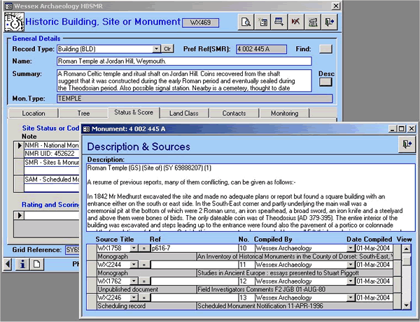
Dorset’s Historic Environment Record is an MS Access database linked to MapInfo GIS software. The database and GIS use HBSMR software. The Record lets the user compile information on historic buildings, monuments, site activities (such as excavations), bibliographic sources, and finds.
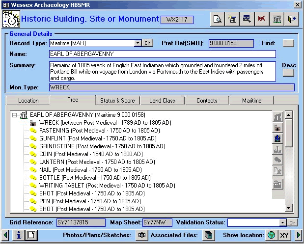
The Site and Monument page displays information on the type of monument with a summary, and shows if there any other monuments, finds or activities associated with the monument.
The user can then select a more detailed description of the monument and look up information on the sources and archives related to the monument.
Information about any work (known as activities) carried out on or near the monument such as a survey or an excavation can be accessed from the Site Activity page.
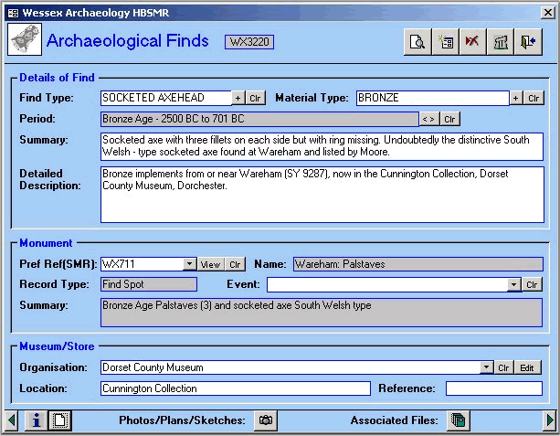
The Finds page gives details of any finds found either as isolated findspots or associated with sites and monuments. It gives a full description of the find and details of where it s now stored.
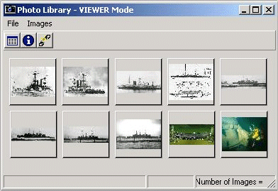
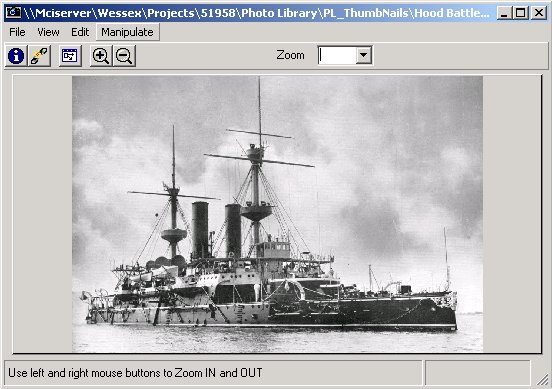
The new HER also has an image viewer that provides links to pictures, plans or sketches for individual sites held as digital images.
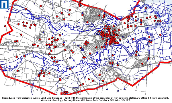
Using the GIS mapping component attached to the HER, the locations of all of the sites (red points) and any archaeological work done in the area (blue triangles) can be clearly seen on a digital map. By selecting a monument or activity of interest on the map the relevant record can be accessed instantly.
The Historic Environment Record is available to the public and Dorset County Council welcomes enquiries.
The Finds
The Finds page displays details of any finds found either as isolated finds or associated with a site or monument. It provides a description of the find and details of where it is stored.
Geograpic Information System (GIS)
Using the GIS mapping component attached to the HER, the locations of all of the sites (red points) and any archaeological work done in the area (blue triangles) can be clearly seen. By selecting a monument or activity of interest on the map the relevant record can be accessed instantly.
Image Viewer
The new HER also has links to pictures, plans or sketches for individual sites held as digital images. These images can be selected and more detailed views displayed as illustrated below.
Site Activity
Information about any work (known as activities) carried out on or near the monument such as a survey or an excavation can be accessed on the Site Activity page.
Sites and Monuments
D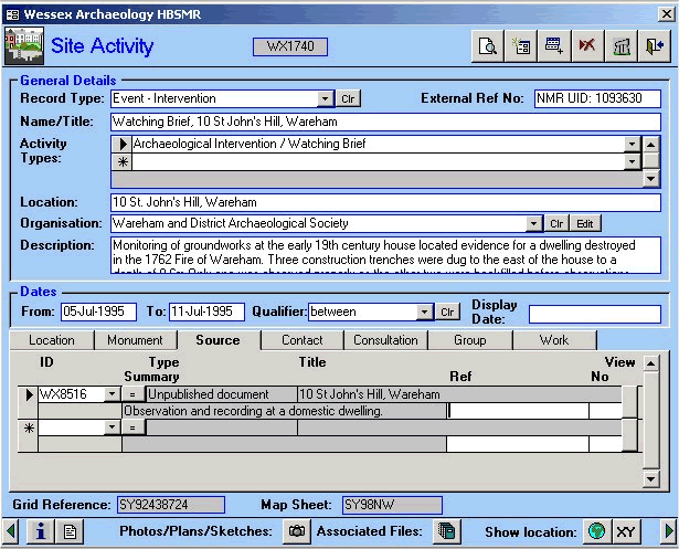
The Sites and Monuments page displays information on the type of monument with a summary, and shows if there any other monuments, finds or activities associated with the monument. The "Desc"; button on this page of the HER opens a new page giving a more detailed description of the monument and a link to source material.
Sources and Archive
From the Description and Sources page the user can select a more detailed description of the monument and look up information on the sources and archives related to the monument.
Description and Sources
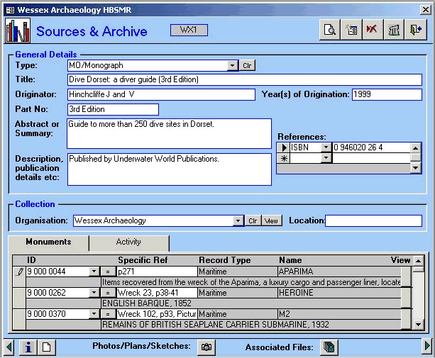
The user can select a more detailed description of the monument and look up information on the sources and archives related to the monument.
Sea Level Change
As part of the Dorset Coast Historic Environment Survey, Wessex Archaeology has created a model of sea level change from the Late Upper Palaeolithic (12,000-10,000 years ago) to the Mid Saxon Period (650-850AD).
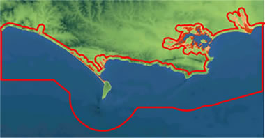
The model was created by combining data on past sea levels, maps of bathymetry (water depth) and contour data (land heights). It has become clear that Dorset’s Coast changed rapidly from the Late Upper Palaeolithic to the Early Neolithic period (from around 10,000 up to 6,000 years ago) due to sea level rise. After this time, the coastline has seen fewer dramatic changes. However, some areas, such as Poole Harbour, only began to approach their current size and shape comparatively recently.
This is the first such model of the evolution of Dorset’s Coast. Models of this kind provide researchers with a valuable tool for identifying areas on the seabed likely to contain evidence of human occupation occurring before sea levels rose, improving our knowledge of past landscapes and human activity beyond the modern shoreline.
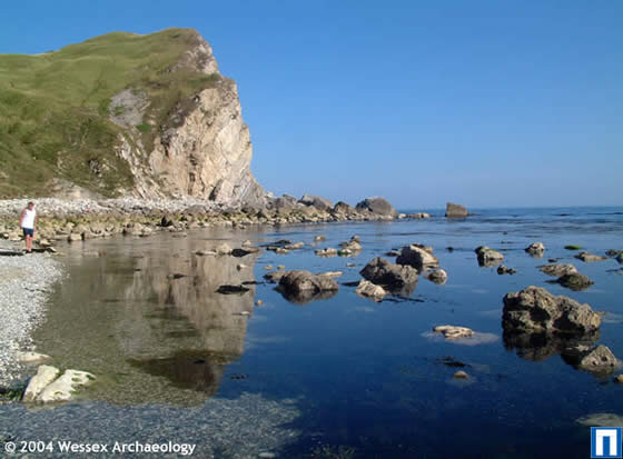
Archaeology and Coastal Change
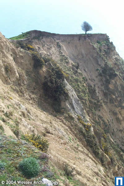
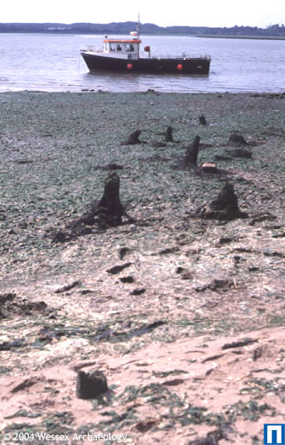
Dorset’s coast has been constantly changing for thousands of years. Erosion and deposition can have huge effects on the historic environment. Ancient sites can be destroyed through the erosion of cliff-faces or become buried deep beneath estuarine silts.
One of the priorities of Wessex Archaeology’s research has been to identify areas where changes might cause damage to archaeological remains.
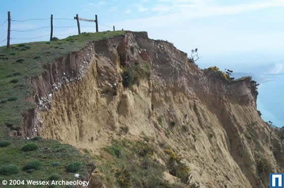
As well as noting known archaeological sites threatened by coastal change, Wessex Archaeology has been able to define areas where there is a high potential for surviving archaeological remains offshore.
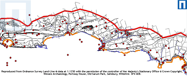
The threat presented to archaeological remains has also been assessed against possible coastal change data from Future Coast. See a section of the Dorset coast with the areas of the coast of immediate interest highlighted in orange.
This information will help DCC prioritise areas for fieldwork in the next stage of the Dorset Coast Historic Environment Survey.
Archaeology at Risk
Here we can see a section of the Dorset coast with areas where sites may be at risk highlighted in orange and known sites shown as red points.