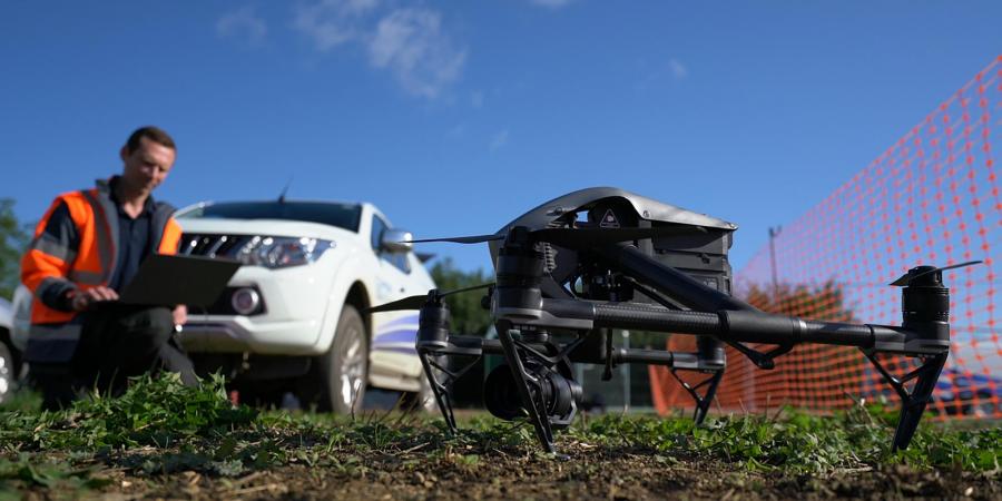
Unmanned Aerial Vehicle (UAV) surveys allow for the rapid collection of high-quality data at a range of scales and resolutions, setting it apart from other survey methods.
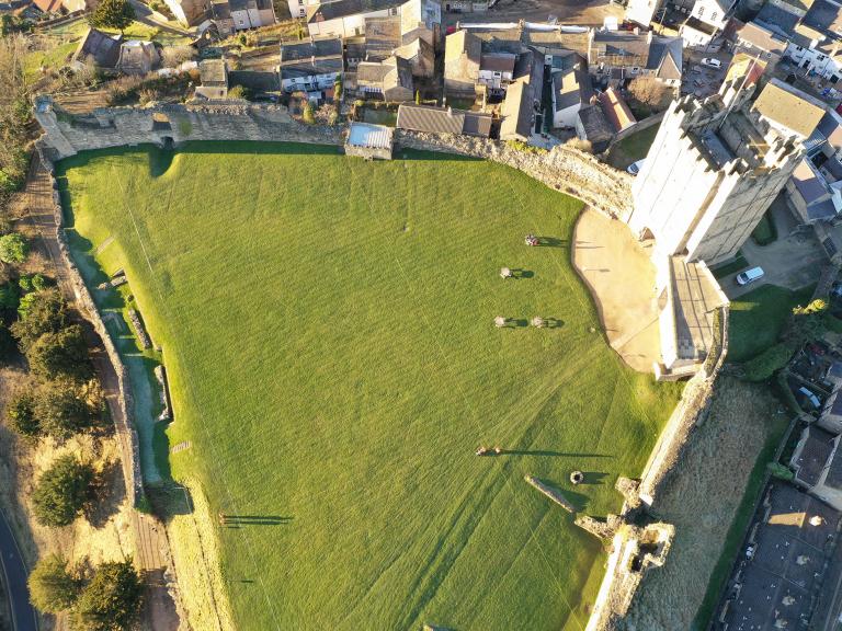
This speed and flexibility makes it an excellent choice for topographic surveys, archaeological aerial reconnaissance and recording buildings. Surveys can be very localised, or can capture an entire landscape. The images can be stitched together to create a single photographic dataset or used to produce a 3D photogrammetric model. UAVs can also be used to collect aerial video and photography and to supplement other forms of survey.
When a UAV Survey is required
We can identify previously unrecorded sites, determine the full extent of known archaeological sites and monitor the condition of buildings or monuments. We can also provide UAV-based multispectral surveys to detect sub-surface archaeology, or utilise UAV based LiDAR to record features hidden under tree cover.
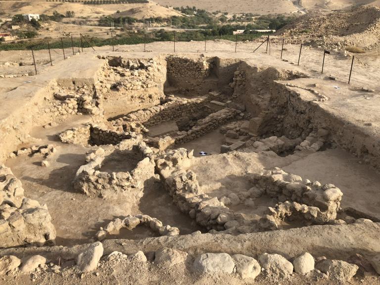
UAVs are also commonly used to map archaeological excavations, and we provide this service for both our own projects and other contractors. This offers the advantage of rapid data collection and verification of any data collected on the ground.
We can provide you with data in a range of formats as well as use it to create visually stunning 3D models, video, still and orthographic images.
Advantages of a UAV Survey
- Very high data resolution makes subtle landscape features more visible.
- Where monuments or buildings are not easily accessible or visible using traditional methods, the UAV survey allows for precise recording of the structure.
- UAV surveys are also invaluable for the rapid surveying of archaeological excavations, volume calculations and condition monitoring.
High-specification equipment
Wessex Archaeology use a range of high-specification equipment and will select the best UAV and camera to meet your project needs. Flights are undertaken by qualified pilots, stationed at each of our offices to provide national coverage. All our work is carried out to the highest safety standards and is designed to comply with Civil Aviation Authority regulations.

Team